Category: Forest

Forest in Malaysia

  • Perlis Herbal Forest: Malaysia’s Living Herbal Museum

    Perlis Herbal Forest: Malaysia’s Living Herbal Museum


    Perlis Herbal Forest

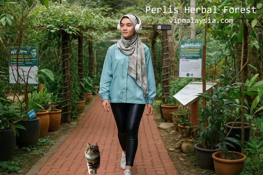
    Nestled within the lush Bukit Bintang Forest Reserve, Perlis Herbal Forest is more than a botanical sanctuary—it’s a treasure trove of over 1000 medicinal plant species. Experience traditional healing, sensory exploration, and nature-infused relaxation in a destination where heritage meets wellness. Visit, learn, and reconnect with Malaysia’s herbal legacy.

    Plan your visit now for a rejuvenating walk through Malaysia’s greenest pharmacy.

    Why Visit

    Overview & Origins

    • Established by Jabatan Perhutanan Negeri Perlis in 1998, opened in 1999
    • Located in Hutan Simpan Bukit Bintang, spanning 12 hectares
    • Functions as a genetic bank and ethnobotanical museum

    Botanical Collection Highlights

    • Houses over 1000 species of herbal and medicinal plants
    • Includes local in-situ plants, ex-situ herbs from other regions, and introduced foreign medicinal flora

    Famous Medicinal Plants at Rimba Herba

    • Tongkat Ali
    • Kacip Fatimah
    • Mengkudu
    • Bunga Tahi Ayam
    • Senduduk
    • Sireh
    • Pinang
    • Kapal Terbang
    • Cekor
    • Sehelai Setahun Baldu
    • Cemumar
    • Kesom
    • Bunga Raya

    Visitor Experience & Educational Impact

    Interactive Learning

    • Experience a “living museum” with interpretative trails and plant panels
    • Touch, smell, and discover traditional herb uses firsthand
    • Learn through self-guided or guided tours

    Wellness Activities

    • Foot soak therapy using herbal oils
    • Foot massages by trained professionals
    • Sampling of herbal drinks for refreshment and health

    Facilities & Features

    What You’ll Find

    • Interpretative walking paths
    • Benches and shaded pavilions
    • Information center
    • Orchid garden
    • Souvenir kiosk
    • Herbal product shop
    • Seminar space

    Fees & Services

    Ticket & Service Rates

    Perlis Herbal Forest Visitor Rates
    Category Malaysian Citizens Non-Malaysian Citizens
    Adult Entry RM2.00 RM5.00
    Children Entry RM1.00 RM3.00
    Persons with Disabilities (OKU) FREE FREE
    Herbal Foot Soak (30 minutes) RM10.00 RM20.00
    Herbal Foot Massage RM15.00 RM30.00

    Quick Info

    Quick Facts: Perlis Herbal Forest
    Attribute Details
    Name Perlis Herbal Forest
    Location Hutan Simpan Bukit Bintang, Kangar, Perlis
    GPS Coordinates 6.537°N, 100.268°E
    Establishment Year 1998
    Public Opening Year 1999
    Total Area 12 hectares
    Management Body Jabatan Perhutanan Negeri Perlis
    Herbal Plant Species Over 1000 species
    Notable Herbs Tongkat Ali, Kacip Fatimah, Mengkudu, Senduduk
    Opening Hours 9:00 AM – 6:00 PM
    Closed Wednesdays (Open on holidays)
    Admission Fees RM1–RM5 (Free for OKU)
    Wellness Services Herbal foot soak, foot massage
    Facilities Interpretive trails, info center, orchid garden
    Experience Type Living museum, educational attraction

    Visitor Testimonials

    “Perlis Herbal Forest offers a peaceful retreat surrounded by nature’s remedies. I was amazed by how everyday plants hold healing secrets we often overlook.” — Nisha L., Selangor

    “Walking through Perlis Herbal Forest felt like reconnecting with generations of herbal wisdom. The guided tour was insightful and the herbal foot soak was incredibly soothing.” — Farhan S., Johor Bahru

    “I didn’t expect Perlis Herbal Forest to have such an extensive collection. Over 1000 medicinal plant species—it’s truly a botanical treasure!” — Emily T., Kuala Lumpur

    “My visit to Perlis Herbal Forest was both educational and relaxing. The interpretive panels taught us so much about local herbs and the massage service was top-tier.” — Ravi G., Perak

    “At Perlis Herbal Forest, every corner is filled with cultural and botanical discoveries. It’s the perfect mix of a nature walk and a holistic wellness journey.” — Chloe N., Melaka

    Contact Info

    Perlis Herbal Forest & Forestry Department Contact Information
    Organization Details
    Perlis Herbal Forest
    • Address: 01000 Kangar, Perlis
    • Phone: 04-977 6626
    Perlis State Forestry Department
    • Address: KM2, Jalan Kaki Bukit, 01000 Kangar, Perlis
    • Email: forestry@perlis.gov.my
    • Phone: 04-9765966 / 04-9776626
    • Fax: 04-9767901
    • Website: https://forestry.perlis.gov.my/

    Final Thoughts

    Perlis Herbal Forest isn’t just a place—it’s a deep, sensory journey into the therapeutic wisdom of nature. With accessible prices, rich culture, and immersive experiences, it offers every visitor a moment of reflection and reconnection. Whether you’re a nature lover, wellness seeker, or heritage enthusiast, it’s a must-visit destination in northern Malaysia.

    Come walk the trail of healing, one herb at a time.


    Perlis Herbal Forest

    Summary

    • Attraction: Perlis Herbal Forest  
    • Location: #Perlis 
    • Attraction Type: #Park #Forest 

    Best Destinations in Perlis

    Uncover Malaysia’s hidden gem where lush landscapes, rich heritage, and colorful village life converge in a truly unique travel experience. Perlis captivates with breathtaking natural beauty, from forested hills and serene lakes to fascinating limestone caves and sprawling rice fields. Wander through authentic local markets, experience time-honored traditions, and indulge in regional flavors that define the heart of northern Malaysia. Whether you’re drawn to eco-adventures, cultural exploration, or rural serenity, Perlis offers soul-stirring moments for every traveler seeking an intimate and unforgettable escape.


    Perlis

    Web Directories

    Looking for travel inspiration, delicious recipes, or the best places to eat? Want to stay updated on smart financial tips, personal loan promotions, or the latest car models? Whether you’re searching for hobby ideas, product reviews, or something new, we’ve got you covered! Click on the links, explore exciting insights, and let your next discovery begin—it’s just one click away!

    1. https://asiaworldtour.com: “Asia World Tour: Your Gateway to Asian and World Adventures”
    2. https://personalfinancingloan.com: “Personal Financing Loan: Your Path to Financial Freedom”
    3. https://hobbyforte.com: “HobbyForte: Discover Your Car Passion, Explore Your Interests”
    4. https://reviewsanything.com: “ReviewsAnything: Your Trusted Source for Honest Gadget Reviews”
    5. https://rumahmampumilik.com: “Rumah Mampu Milik: Your Affordable Homeownership Journey Begins Here”
    6. https://malaysiadigit.com: “MalaysiaDigit: Your Digital Destination for News and Insights”
    7. https://vipmalaysia.com: “VIP Malaysia: Elevate Your Experience in Malaysia”
    8. https://vipmalaysia.com: “Indulge in Elegance at Nordiyana: Latest Recipe and Culinary Inspirations”
    9. https://e-penyatagaji.com: “E-Penyata Gaji: Simplifying Payroll Management for You”
    10. https://googleasia.org: “Google Asia: Explore the World and Asia’s Wonders with Google Asia”
    11. https://malaysiafit.com: “Malaysia Fit: Your Partner in Health and Wellness”
    12. https://koperasi.info: “Koperasi: Building Communities, Empowering Lives”
    13. https://recipeinside.com: “RecipeInside: Unveiling Culinary Creations, Your Guide to Delicious Dishes”
    14. https://asiahealthcenter.com: “Asia Health Center: Your Source for Holistic Wellness Solutions”
    15. https://nationalhealthcenters.com: “National Health Centers: Your Source for Vital Health Information and Community Care”
    16. https://malaysiabit.com: “MalaysiaBit: Stay Informed, Stay Connected”
    17. https://epenyatagaji.com: “E-Penyata Gaji: Your Digital Payslip Solution”
    18. https://koperasi.work: “Koperasi Work: Collaborate, Innovate, Succeed”
    19. https://koperasi.business: “Koperasi Business: Driving Entrepreneurship, Fostering Growth”
  • Bukit Mertajam Recreational Forest: Hidden Highland Retreat

    Bukit Mertajam Recreational Forest: Hidden Highland Retreat


    Bukit Mertajam Recreational Forest

    Tucked away in the heart of Seberang Perai, Bukit Mertajam Recreational Forest—also known as Cherok Tok Kun—is a lush 37-hectare rainforest sanctuary perfect for hiking, picnicking, and reconnecting with nature. With towering trees, jungle trails, and tranquil streams, it’s a favorite among locals and travelers seeking a peaceful escape. Whether you’re chasing waterfalls or conquering the summit, this forest park offers a refreshing dose of Penang’s natural beauty.

    Ready to explore Penang’s mainland gem? Lace up your hiking boots and let the forest adventure begin.

    Why Visit

    Location & Access

    A Nature Lover’s Escape Just Minutes from the City

    • Located in Bukit Mertajam, Seberang Perai Tengah, Penang
    • Just 6 km from Bukit Mertajam town
    • GPS Coordinates: 5.366735, 100.483353

    By Car

    • Exit Juru Toll from the North-South Expressway
    • Head toward Bukit Mertajam, then follow signs to Kulim

    By Public Transport

    • No direct bus access to the forest
    • Use Grab or taxi from Bukit Mertajam town center

    What’s Best Here

    Introduction to the Park

    • Known locally as Cherok Tok Kun
    • Covers 37 hectares with a peak elevation of 545 meters
    • Home to rare trees like Meranti Seraya (Shorea curtisii) and Meranti Rambai Daun (Shorea acuminata)

    Activities & Attractions

    Hiking & Trekking

    • Multiple jungle trails including the Jeep Track
    • Trek to summit takes ~1 hour for moderate hikers
    • Popular with mountain bikers and trail runners

    Nature & Wildlife

    • Spot exotic birds, insects, and native flora
    • Listen to forest sounds as you ascend

    Water Features

    • Natural pools and mini waterfalls for dipping and cooling off

    Rest Stations

    • Station 3 offers refreshments by volunteers
    • Scenic viewpoints near the summit

    Unique Tree Encounter

    • Giant tree with roots as tall as two adults
    • Located along the trail to Station 2

    Facilities Available

    • Parking lots
    • Toilets
    • Food stalls
    • Rest huts
    • Football field
    • Basic info signage

    Quick Info

    Bukit Mertajam Recreational Forest Overview
    Attribute Details
    Name Bukit Mertajam Recreational Forest
    Also Known As Cherok Tok Kun
    Location Bukit Mertajam, Seberang Perai Tengah, Penang
    GPS Position 5.366735, 100.483353
    Size 37 hectares
    Elevation 545 meters above sea level
    Forest Type Secondary Rainforest
    Opening Hours Daily, 7:00 AM – 7:00 PM
    Entrance Fee Free
    Main Trails Jeep Track, Station 2 Trail, Summit Trail
    Flora Meranti Seraya, Meranti Rambai Daun
    Wildlife Birds, macaques, insects
    Facilities Parking, toilets, food stalls, rest huts
    Nearby Town Bukit Mertajam (6 km)

    User Reviews & Testimonials

    “The hike to the summit was challenging but rewarding. The views and fresh air at Bukit Mertajam Recreational Forest were worth every step.” – Shazwan, Penang

    “At Bukit Mertajam Recreational Forest, I loved the peaceful atmosphere and the giant tree was a highlight. Great spot for weekend nature therapy.” – Chai Pas, Kuala Lumpur

    “Perfect for morning jogs and family picnics. Bukit Mertajam Recreational Forest is well-maintained and not too crowded.” – Prakash Sensodyne, Butterworth

    Contact Information

    Bukit Mertajam Recreational Forest & Visitor Services
    Location Details
    Bukit Mertajam Recreational Forest
    • Address: Pejabat Renjer Hutan SPU/SPT, Taman Rimba Bukit Mertajam, Jalan Kolam Air, 14000 Bukit Mertajam, Pulau Pinang
    • Operating Days: Monday – Sunday
    • Operating Hours: 7:00 AM – 7:00 PM
    • Office Hours: Monday – Friday, 8:00 AM – 5:00 PM (except public holidays)
    • Contact Number: +604 539 1743
    • Website: jhn.penang.gov.my
    Tourist Information Centre – George Town
    • Address: 8B, First Floor, The Whiteaways Arcade, Lebuh Pantai, 10300 Penang, Malaysia
    • Phone: +604 264 3456
    • Operation Hours:
      • Monday – Friday, 9:00 AM – 5:00 PM
      • Saturday & Sunday: Closed
    • Website: mypenang.gov.my
    Penang State Forestry Department
    • Address: Jabatan Perhutanan Negeri, Pulau Pinang, Tingkat 20, Menara KOMTAR, 10300 Pulau Pinang
    • Tel: 04-6505 250
    • Fax: 04-2636 335
    • Open Daily: 7:00 AM – 6:00 PM
    • Emergency Services:
      • Call 911
      • Hospital Bukit Mertajam – 10 km (04-5383 333)
      • Machang Bubuk Police Station – 5 km (04-5511 629)
      • Mukit Mertajam Fire Station – 9 km (04-5384 444)
    Forestry Department of Peninsular Malaysia Headquarters
    • Address: Jalan Sultan Salahuddin, 50660 Kuala Lumpur
    • Phone: 603-2616 4488
    • Fax: 603-2692 5657
    • Email: webmaster@forestry.gov.my
    • Website: forestry.gov.my

    Final Thoughts

    Bukit Mertajam Recreational Forest is more than just a hiking spot—it’s a sanctuary for the soul. With its towering trees, scenic trails, and peaceful ambiance, it’s a must-visit for anyone seeking nature’s embrace in Penang.

    Whether you’re a seasoned trekker or a weekend wanderer, this forest welcomes you with open arms and leafy trails.


    Bukit Mertajam Recreational Forest

    Summary

    • Attraction: Bukit Mertajam Recreational Forest 
    • Location: #Penang 
    • Attraction Type: #Forest 

    Best Destinations in Penang

    Experience the heart of Penang through its rich cultural tapestry, stunning coastal landscapes, and vibrant local traditions. From serene seafronts and lush hillsides to colorful street scenes and heritage marvels, Penang offers a captivating blend of nature and culture. Dive into a world of unforgettable flavors, charming architecture, and warm hospitality—all waiting to be discovered on this iconic Malaysian island.

    Penang War Museum: Where WWII History Comes Alive

    Penang War Museum Explore Southeast Asia’s largest war museum at Batu Maung, Penang—uncover forgotten military bunkers, anti-aircraft pits, bullet-riddled walls, and chilling memories of WWII…

    Penang State Museum: History & Hospitality

    Penang State Museum Step into Penang State Museum—an architectural and cultural beacon since 1965—then unwind just minutes away at Cititel Penang, a 4-star landmark hotel…


    Penang

    Web Directories

    Looking for travel inspiration, delicious recipes, or the best places to eat? Want to stay updated on smart financial tips, personal loan promotions, or the latest car models? Whether you’re searching for hobby ideas, product reviews, or something new, we’ve got you covered! Click on the links, explore exciting insights, and let your next discovery begin—it’s just one click away!

    1. https://asiaworldtour.com: “Asia World Tour: Your Gateway to Asian and World Adventures”
    2. https://personalfinancingloan.com: “Personal Financing Loan: Your Path to Financial Freedom”
    3. https://hobbyforte.com: “HobbyForte: Discover Your Car Passion, Explore Your Interests”
    4. https://reviewsanything.com: “ReviewsAnything: Your Trusted Source for Honest Gadget Reviews”
    5. https://rumahmampumilik.com: “Rumah Mampu Milik: Your Affordable Homeownership Journey Begins Here”
    6. https://malaysiadigit.com: “MalaysiaDigit: Your Digital Destination for News and Insights”
    7. https://vipmalaysia.com: “VIP Malaysia: Elevate Your Experience in Malaysia”
    8. https://vipmalaysia.com: “Indulge in Elegance at Nordiyana: Latest Recipe and Culinary Inspirations”
    9. https://e-penyatagaji.com: “E-Penyata Gaji: Simplifying Payroll Management for You”
    10. https://googleasia.org: “Google Asia: Explore the World and Asia’s Wonders with Google Asia”
    11. https://malaysiafit.com: “Malaysia Fit: Your Partner in Health and Wellness”
    12. https://koperasi.info: “Koperasi: Building Communities, Empowering Lives”
    13. https://recipeinside.com: “RecipeInside: Unveiling Culinary Creations, Your Guide to Delicious Dishes”
    14. https://asiahealthcenter.com: “Asia Health Center: Your Source for Holistic Wellness Solutions”
    15. https://nationalhealthcenters.com: “National Health Centers: Your Source for Vital Health Information and Community Care”
    16. https://malaysiabit.com: “MalaysiaBit: Stay Informed, Stay Connected”
    17. https://epenyatagaji.com: “E-Penyata Gaji: Your Digital Payslip Solution”
    18. https://koperasi.work: “Koperasi Work: Collaborate, Innovate, Succeed”
    19. https://koperasi.business: “Koperasi Business: Driving Entrepreneurship, Fostering Growth”
  • Bukit Besi Rainforest Endurance Park: For Nature & Adventure

    Bukit Besi Rainforest Endurance Park: For Nature & Adventure


    Bukit Besi Rainforest Endurance Park

    Nestled in the heart of Dungun, Terengganu, Bukit Besi Rainforest Endurance Park (BBREP) is a sprawling recreational haven built on the legacy of iron mining. With its scenic man-made lake, jungle trails, and adrenaline-pumping endurance tracks, this park offers a rare blend of tranquility and thrill. Whether you’re here for a family picnic or an extreme sports challenge, BBREP promises a refreshing escape into nature.

    Ready to explore Terengganu’s most versatile rainforest park? Let’s dive into everything Bukit Besi has to offer.

    Why Visit

    A Legacy Reimagined

    • Built around Tasik Puteri, a 131-hectare lake formed from former iron mining pits
    • Transformed into a vibrant eco-recreation zone

    Adventure for All Ages

    • 31 km multi-use endurance track for ATV, horse riding, mountain biking, marathon, and motocross
    • Jungle trekking and hill hiking trails for nature lovers

    Family-Friendly Facilities

    • Picnic areas, playgrounds, prayer rooms, food stalls, and changing rooms
    • Artificial swimming pools with depth zones for different age groups

    Attractions & Activities

    Water-Based Fun

    Tasik Puteri

    • Scenic lake ideal for kayaking, fishing, and lakeside relaxation
    • Slipway and jetties for easy access

    Swimming Pools

    • First diving board-equipped pool in Peninsular Malaysia (built in 1950)
    • Separate pools for adults and children

    Land Adventures

    BBREP Endurance Track

    • 31 km of rugged terrain for extreme sports
    • Popular for ATV rides, trail runs, and mountain biking

    Jungle Trekking & Hiking

    • Trails through lush rainforest and former mining hills
    • Ideal for eco-study and nature photography

    Quick Info

    Bukit Besi Rainforest Endurance Park Visitor Information
    Attribute Details
    Address Tasik Puteri, Bukit Besi, Dungun District, Terengganu, 23200, Malaysia
    GPS Position 4.7600° N, 103.2000° E
    State Terengganu
    Lake Size 131 hectares
    Endurance Track 31 km multi-use trail
    Swimming Pools Two pools (adult and children), built in 1950
    Nearby Towns Dungun (77 km), Al-Muktafi Billah Shah (44 km), Kuala Terengganu (138 km)
    Admission Fee Free
    Opening Hours Daily: 8:00 AM – 8:00 PM
    Facilities Esplanade, playground, jetties, slipway, surau, toilets, food stalls, changing rooms, campsite, waterfall, swimming pools
    Popular Activities ATV, hiking, jungle trekking, camping, swimming, photography
    Parking Available onsite
    Permit Requirement Not required for casual visits; check for group activity permits
    Nearby Attractions Chemerong Waterfall, Bukit Bauk Urban Forest, Teluk Bidara Beach
    Contact Rainforest Park Office: +6017-3001272
    Navigation Use Google Maps or Waze and search “Bukit Besi Rainforest Endurance Park”

    User Reviews & Testimonials

    “Bukit Besi Rainforest Park is a hidden gem. The ATV trail was thrilling and the lake views were stunning. Perfect for a weekend escape.” – Steve Mac, Kuala Lumpur

    “We brought our kids and they loved the swimming pools and playground. The facilities at Bukit Besi Rainforest Park were clean and the atmosphere was peaceful.” – Jason King, Dungun

    “I joined a trail run here at Bukit Besi Rainforest Park and it was one of the best routes I’ve experienced. Challenging terrain and beautiful rainforest scenery.” – Louis Ben, Penang

    Contact & Booking Information

    Bukit Besi Rainforest Endurance Park – Visitor Essentials
    Attribute Details
    Park Office Telephone Number: 6017-3001272
    Navigation Search Bukit Besi Rainforest Endurance Park on Google Maps or Waze
    Parking Parking is available onsite
    Admission Admission is free
    Permit Permit is not required for casual visits; group activities may require prior arrangement
    Best Season Open year-round; early mornings and weekends are recommended
    Bukit Besi Rainforest Endurance Park – Official Contact Directory
    Organization Details
    Taman Rekreasi Bukit Besi
    • Address: Bandar Bukit Besi, 23200 Dungun, Terengganu
    • Website: tourism.ketengah.gov.my
    State Secretary Office of Terengganu
    • Address: Wisma Darul Iman, 20503 Kuala Terengganu
    • General Line: 09-6006000
    • Email: webmaster at terengganu dot gov dot my
    • Website: terengganu.gov.my
    Swimming Pool Bukit Besi
    • Location: Bukit Besi, Dungun, Terengganu
    • Fixed Line Number: 09-8339249
    • Operating Hours: Daily from 09:00 AM to 04:00 PM
    • Notes:
      • Closed on public holidays
      • On Friday, closed from 12:30 PM to 2:30 PM and reopens until 4:00 PM
    Central Terengganu Development Authority (KETENGAH)
    • Address: Locked Bag Number 3, 23409, Al-Muktafi Billah Shah, Terengganu
    • Telephone: 09-8231000
    • Fax: 09-8223105
    • Website: ketengah.gov.my

    Final Thoughts

    Bukit Besi Rainforest Endurance Park is more than just a recreational space—it’s a living tribute to Terengganu’s natural beauty and adventurous spirit. From its tranquil lake to its adrenaline-fueled trails, this destination offers something for everyone. Whether you’re planning a family outing, a solo hike, or an extreme sports challenge, BBREP welcomes you with open arms and endless possibilities.

    Pack your gear, bring your sense of adventure, and let Bukit Besi show you the wild side of Terengganu.


    Bukit Besi Rainforest Endurance Park

    Summary

    • Attraction: Bukit Besi Rainforest Endurance Park 
    • Location: #Terengganu 
    • Attraction Type: #Activity 

    Best Destinations in Terengganu 

    Discover the best destinations in Terengganu, Malaysia—from pristine beaches and crystal-clear islands to vibrant cultural heritage and traditional crafts. Whether you’re exploring the iconic Redang Island, strolling through Kuala Terengganu’s charming markets, or marveling at the Floating Mosque, Terengganu promises breathtaking natural beauty and unforgettable local experiences.


    Terengganu

    Web Directories

    Looking for travel inspiration, delicious recipes, or the best places to eat? Want to stay updated on smart financial tips, personal loan promotions, or the latest car models? Whether you’re searching for hobby ideas, product reviews, or something new, we’ve got you covered! Click on the links, explore exciting insights, and let your next discovery begin—it’s just one click away!

    1. https://asiaworldtour.com: “Asia World Tour: Your Gateway to Asian and World Adventures”
    2. https://personalfinancingloan.com: “Personal Financing Loan: Your Path to Financial Freedom”
    3. https://hobbyforte.com: “HobbyForte: Discover Your Car Passion, Explore Your Interests”
    4. https://reviewsanything.com: “ReviewsAnything: Your Trusted Source for Honest Gadget Reviews”
    5. https://rumahmampumilik.com: “Rumah Mampu Milik: Your Affordable Homeownership Journey Begins Here”
    6. https://malaysiadigit.com: “MalaysiaDigit: Your Digital Destination for News and Insights”
    7. https://vipmalaysia.com: “VIP Malaysia: Elevate Your Experience in Malaysia”
    8. https://vipmalaysia.com: “Indulge in Elegance at Nordiyana: Latest Recipe and Culinary Inspirations”
    9. https://e-penyatagaji.com: “E-Penyata Gaji: Simplifying Payroll Management for You”
    10. https://googleasia.org: “Google Asia: Explore the World and Asia’s Wonders with Google Asia”
    11. https://malaysiafit.com: “Malaysia Fit: Your Partner in Health and Wellness”
    12. https://koperasi.info: “Koperasi: Building Communities, Empowering Lives”
    13. https://recipeinside.com: “RecipeInside: Unveiling Culinary Creations, Your Guide to Delicious Dishes”
    14. https://asiahealthcenter.com: “Asia Health Center: Your Source for Holistic Wellness Solutions”
    15. https://nationalhealthcenters.com: “National Health Centers: Your Source for Vital Health Information and Community Care”
    16. https://malaysiabit.com: “MalaysiaBit: Stay Informed, Stay Connected”
    17. https://epenyatagaji.com: “E-Penyata Gaji: Your Digital Payslip Solution”
    18. https://koperasi.work: “Koperasi Work: Collaborate, Innovate, Succeed”
    19. https://koperasi.business: “Koperasi Business: Driving Entrepreneurship, Fostering Growth”
  • Bukit Bauk Urban Forest: Terengganu’s Hidden Gem for Nature

    Bukit Bauk Urban Forest: Terengganu’s Hidden Gem for Nature


    Bukit Bauk Urban Forest

    Just minutes from Dungun town, Bukit Bauk Urban Forest offers a refreshing escape into nature with lush trails, serene picnic spots, and panoramic hilltop views. Whether you’re here to hike, jog, meditate, or simply breathe in the forest air, this eco-park is a sanctuary for wellness seekers and outdoor lovers alike.

    Ready to reconnect with nature? Let’s explore why Bukit Bauk belongs on your travel list.

    Why Visit

    A Forest in the City

    • Located just 6 km from Dungun Town
    • Nestled in Bukit Bauk Forest Reserve
    • Features Hill Dipterocarp, Lowland Dipterocarp, and Peat Swamp Forests

    Wellness & Recreation

    • Jogging tracks, walking trails, and green squares
    • Ideal for morning workouts, sunset strolls, and forest meditation

    Adventure & Exploration

    • Jungle trekking and hill climbing
    • Trail to Bukit Bauk Peak (472 meters above sea level)
    • Study trails and eco-education programs

    Attractions & Activities

    Hiking & Trekking

    Bukit Bauk Peak Trail

    • Moderate difficulty, 3.1 miles round trip
    • Elevation gain: 1,026 ft
    • Estimated time: 2 hours

    Forest Trails

    • Benches and rest stops along the way
    • Trail markers and maps available

    Picnicking & Relaxation

    Green Square & Pondok

    • Shaded gazebos and picnic tables
    • Ideal for family outings and group gatherings

    Kafe Rimba

    • Local café serving refreshments and light meals
    • Located near the trail entrance

    Quick Info

    Bukit Bauk Urban Forest Visitor Information
    Attribute Details
    Address Jalan Bukit Bauk, Dungun District, Terengganu, 23000, Malaysia
    GPS Position 4.6936° N, 103.4113° E
    State Terengganu
    Forest Type Hill Dipterocarp, Lowland Dipterocarp, Peat Swamp Forest
    Distance from Dungun 6 km
    Distance from Kuala Terengganu 130 km via Kuala Terengganu–Dungun Road
    Admission Fee Free
    Opening Hours Daily: 6:00 AM – 7:00 PM
    Facilities Information center, jogging tracks, toilets, prayer rooms, green square
    Nearby Café Kafe Rimba Bandar Bukit Bauk
    Nearby Attractions Pasar Besar Dungun, Teluk Bidara Beach, Chemerong Waterfall
    Popular Activities Hiking, jogging, trekking, nature study, photography
    Parking Available onsite
    Permit Requirement Not required for day visits; hiking permits may apply
    Emergency Contact Hospital Dungun: 09-8583 333 | Police: 09-8482 222 | Fire Dept: 09-8261 444
    Contact Pejabat Hutan Daerah Terengganu Selatan: 09-8441 404

    User Reviews & Testimonials

    “Bukit Bauk is my go-to spot for weekend hikes. The trail is peaceful, and the views from the top are stunning. It’s a great place to clear your mind.” – Suzuka, Kuala Lumpur

    “I love how accessible this forest is. Just a short drive from town and you’re surrounded by nature. The facilities are clean and well-maintained.” – Hisyammuddin Tajul Urus, Dungun

    Contact & Booking Information

    Bukit Bauk Urban Forest – Visitor Essentials
    Attribute Details
    Forest Office Pejabat Hutan Daerah Terengganu Selatan – Telephone Number: 09-8441 404
    Navigation Use Google Maps or Waze and search for Bukit Bauk Urban Forest
    Parking Parking is available onsite
    Admission Admission is free
    Permit Permit is not required for casual visits; check with forest office for hiking group permits
    Best Season Open year-round; early mornings and evenings are recommended
    Bukit Bauk Urban Forest – Forestry & Emergency Contact Directory
    Agency Details
    State Forestry Department Terengganu
    • Address: Unit Hutan Lipur dan Rekreasi, Jabatan Perhutanan Negeri Terengganu, Tingkat 8, Wisma Negeri, 20200 Kuala Terengganu, Terengganu
    • Telephone Number: 09-6222444, 09-6274120, 09-6274123, 09-6274125
    • Fax Number: 09-6236552
    • Email: phnt at terengganu dot gov dot my
    District Forestry Office Terengganu North
    • Address: Pejabat Hutan Daerah Terengganu Utara, Batu 6, 21200 Kuala Terengganu, Terengganu
    • Telephone Number: 09-6667473, 09-6672834
    • Fax Number: 09-6667061
    • Email: phdtu at terengganu dot gov dot my
    District Forestry Office Terengganu West
    • Address: Pejabat Hutan Daerah Terengganu Barat, Batu 21, Jalan Besar Ajil – Kuala Berang, 21800 Ajil, Terengganu
    • Telephone Number: 09-6811259
    • Fax Number: 09-6812767
    • Email: phdtb at terengganu dot gov dot my
    District Forestry Office Terengganu South
    • Address: Pejabat Hutan Daerah Terengganu Selatan,23000 Dungun, Terengganu
    • Telephone Number: 09-8481404
    • Fax Number: 09-8483199
    • Email: phdts at terengganu dot gov dot my
    Forestry Department of Peninsular Malaysia
    • Address: Headquarters, Jalan Sultan Salahuddin, 50660 Kuala Lumpur
    • Telephone Number: 603-26164488
    • Fax Number: 603-26925657
    • Email: webmaster at forestry dot gov dot my
    • Website: forestry.gov.my
    • Terengganu Portal: terengganu.gov.my
    Emergency Services
    • Emergency Call:
      • Call Nine One One
      • Hospital Dungun – Five kilometers away – Telephone Number: 09-8583 333
      • District Police Station Dungun – Five kilometers away – Telephone Number: 09-8482 222
      • Fire Station Dungun – Five kilometers away – Telephone Number: 09-8261 444

    Final Thoughts

    Bukit Bauk Urban Forest is more than just a park—it’s a living classroom, a wellness retreat, and an adventure playground all rolled into one. Whether you’re chasing sunrise views, studying forest ecology, or simply enjoying a quiet walk, this destination offers something for everyone.

    So, lace up your shoes, grab your water bottle, and let Bukit Bauk show you the magic of Terengganu’s natural heritage.


    Bukit Bauk Urban Forest

    Summary

    • Attraction: Bukit Bauk Urban Forest 
    • Location: #Terengganu 
    • Attraction Type: #Nature #Forest 

    Best Destinations in Terengganu 

    Discover the best destinations in Terengganu, Malaysia—from pristine beaches and crystal-clear islands to vibrant cultural heritage and traditional crafts. Whether you’re exploring the iconic Redang Island, strolling through Kuala Terengganu’s charming markets, or marveling at the Floating Mosque, Terengganu promises breathtaking natural beauty and unforgettable local experiences.


    Terengganu

    Web Directories

    Looking for travel inspiration, delicious recipes, or the best places to eat? Want to stay updated on smart financial tips, personal loan promotions, or the latest car models? Whether you’re searching for hobby ideas, product reviews, or something new, we’ve got you covered! Click on the links, explore exciting insights, and let your next discovery begin—it’s just one click away!

    1. https://asiaworldtour.com: “Asia World Tour: Your Gateway to Asian and World Adventures”
    2. https://personalfinancingloan.com: “Personal Financing Loan: Your Path to Financial Freedom”
    3. https://hobbyforte.com: “HobbyForte: Discover Your Car Passion, Explore Your Interests”
    4. https://reviewsanything.com: “ReviewsAnything: Your Trusted Source for Honest Gadget Reviews”
    5. https://rumahmampumilik.com: “Rumah Mampu Milik: Your Affordable Homeownership Journey Begins Here”
    6. https://malaysiadigit.com: “MalaysiaDigit: Your Digital Destination for News and Insights”
    7. https://vipmalaysia.com: “VIP Malaysia: Elevate Your Experience in Malaysia”
    8. https://vipmalaysia.com: “Indulge in Elegance at Nordiyana: Latest Recipe and Culinary Inspirations”
    9. https://e-penyatagaji.com: “E-Penyata Gaji: Simplifying Payroll Management for You”
    10. https://googleasia.org: “Google Asia: Explore the World and Asia’s Wonders with Google Asia”
    11. https://malaysiafit.com: “Malaysia Fit: Your Partner in Health and Wellness”
    12. https://koperasi.info: “Koperasi: Building Communities, Empowering Lives”
    13. https://recipeinside.com: “RecipeInside: Unveiling Culinary Creations, Your Guide to Delicious Dishes”
    14. https://asiahealthcenter.com: “Asia Health Center: Your Source for Holistic Wellness Solutions”
    15. https://nationalhealthcenters.com: “National Health Centers: Your Source for Vital Health Information and Community Care”
    16. https://malaysiabit.com: “MalaysiaBit: Stay Informed, Stay Connected”
    17. https://epenyatagaji.com: “E-Penyata Gaji: Your Digital Payslip Solution”
    18. https://koperasi.work: “Koperasi Work: Collaborate, Innovate, Succeed”
    19. https://koperasi.business: “Koperasi Business: Driving Entrepreneurship, Fostering Growth”
  • Selangor Hiking Trails: Best Routes & Rules

    Selangor Hiking Trails: Best Routes & Rules

    Top Hiking Trails in Selangor

    Discover Selangor’s most breathtaking hiking trails — from Bukit Kutu to Gunung Nuang — while staying safe and legal. Learn which routes require permits, when licensed forest guides (MGP) are mandatory, and how to avoid costly fines.

    Introduction

    Selangor, Malaysia’s vibrant state bordering Kuala Lumpur, is home to lush rainforests, waterfalls, and mountain peaks that attract thousands of hikers each year. Whether you’re chasing sunrise views at Bukit Broga or tackling the challenging ascent of Gunung Nuang, one thing is certain: hiking here isn’t just about stamina, it’s about following the rules. Since 2025, the Selangor Forestry Department has tightened regulations, requiring permits for all hikes in forest reserves and licensed forest mountain guides (MGP) for specific trails. This ensures safety, preserves fragile ecosystems, and promotes responsible ecotourism.

    Permit Requirements

    Every trail within Selangor’s permanent forest reserves now requires a permit via the SeForest e-Permit system. Applications must be submitted at least 48 hours before your hike, with a fee of RM5 per person. Rangers stationed at trailheads often check permits, and failure to comply can result in fines up to RM30,000 or imprisonment under the National Forestry Act 1984.

    Trails Requiring Licensed Guides (MGP)

    Not all trails demand a guide, but several of Selangor’s most iconic hikes do. These include:

    • Gunung Nuang (via Pangsun) – The tallest peak in Selangor, known for its strenuous climb.
    • Bukit Kutu – A historic colonial hill station offering panoramic views.
    • Pine Tree Hill – A popular Fraser’s Hill trek with steep ascents.
    • Gunung Semangkok – A challenging ridge hike connecting Fraser’s Hill and Raub.
    • Gunung Rajah (via Kuala Kubu Bharu) – A demanding trail with river crossings.

    Licensed guides are trained in first aid, equipped with radios, and ensure hikers return before cutoff times. This reduces risks of getting lost or stranded overnight.

    Why These Rules Matter

    1. Safety First – Trails like Gunung Nuang can take over 10 hours to complete. Guides help prevent accidents and coordinate rescues.
    2. Legal Compliance – Hiking without permits or guides where required can lead to severe penalties.
    3. Ecotourism Support – Fees and guide services contribute to forest conservation and sustainable tourism.

    Bukit Kutu vs. Bukit Broga

    TrailDetails
    Bukit KutuPermit: Yes Guide (MGP): Yes Difficulty: Hard Highlights: Colonial ruins, ladders, panoramic summit
    Bukit BrogaPermit: Yes Guide (MGP): No Difficulty: Easy–Moderate Highlights: Sunrise views, grassland summit

    Conclusion

    Selangor’s hiking trails are among Malaysia’s finest, offering everything from misty sunrises to rugged mountain challenges. But with beauty comes responsibility. By securing permits and hiring licensed guides where required, hikers not only protect themselves but also contribute to preserving these natural gems for future generations. Hiking smarter, safer, and legally ensures that Selangor’s forests remain a sanctuary for both adventurers and wildlife.

    Summary

    • Attraction: Hiking Trails in Selangor
    • Location: #Selangor 
    • Attraction Type: #Activity #Mount #Forest #NationalPark 
    • Source: nordiyana.com

    Hiking Trail Requirements

    Trail NameMGP Guide RequiredPermit Required
    Bukit BrogaNoYes
    Bukit SagaNoYes
    Bukit TakunNoYes
    Bukit Batu ChondongNoYes
    Bukit JugraNoYes
    Bukit ApekNoYes
    Bukit KembaraNoYes
    Bukit LagongNoYes
    Bukit Permatang KuangNoYes
    Bukit Sapu TanganNoYes
    Bukit Batu TaborNoYes
    Bukit Pokok PineNoYes
    Bukit PayongNoYes
    Bukit Genting ChabangNoYes
    Bukit TunggulNoYes
    Bukit IrdomNoYes
    Bukit MachongNoYes
    Bukit ChangkatNoYes
    Bukit Batu PahatNoYes
    Bukit Resam AmbatNoYes
    Bukit AngkauNoYes
    Bukit BangkongNoYes
    Bukit Moyang KabanNoYes
    Bukit Lapan BelasNoYes
    Bukit GumpangNoYes
    Bukit Genting JemeloiNoYes
    Bukit Chinchang SebarauNoYes
    Bukit Menggaru MatiNoYes
    Bukit Hulu KalongNoYes
    Bukit Hulu RumputNoYes
    Genting BidaiNoYes
    Genting PeresNoYes

    Trails Requiring Permit + MGP Guide

    Trail NameMGP Guide RequiredPermit Required
    Gunung NuangYesYes
    Bukit KutuYesYes
    Pine Tree HillYesYes
    Gunung SemangkokYesYes
    Gunung RajahYesYes
    Gunung Hulu KaliYesYes
    Gunung Hulu SemangkokYesYes
    Gunung Semangkok GapYesYes
    Gunung Ulu LenikYesYes
    Gunung HitamYesYes
    Bukit Hulu TelangYesYes
    Bukit Hulu BakauYesYes
    Bukit BoyanYesYes
    Bukit ChorocoYesYes
    Bukit KunongYesYes
    Bukit UnyangYesYes
    Bukit CenuangYesYes

    Visitor Review

    Norsuhailah Binti Abdul Majid “I recently hiked Bukit Kutu with an MGP guide, and the experience was incredible. The guide not only ensured our safety but also shared fascinating stories about the colonial ruins at the summit. Applying for the permit was straightforward, and I felt reassured knowing we were hiking legally. Compared to my earlier hikes without permits, this felt more organized and respectful of nature. I’d recommend anyone planning a hike in Selangor to follow the rules — it makes the adventure safer and more meaningful.”

    Jasmin Aleeza Abdul Sahak, Kuala Lumpur-based hiker shared his experience on Bukit Kutu: “Bukit Kutu is one of the toughest hikes I’ve done in Selangor. It took me about 4 hours to reach the summit, with three river crossings along the way. The terrain is steep, and there are sections where you need to climb metal ladders bolted into boulders. A permit and guide were required — we arranged ours beforehand, and the guide was invaluable in keeping us on track and ensuring we returned safely. Parking near Kampung Pertak cost RM2, and the permit was RM5 per person. The summit rewarded us with panoramic views and remnants of the old colonial hill station. It’s definitely not a beginner-friendly trail, but the sense of accomplishment was incredible.”

  • Endau Rompin National Park: Malaysia’s Ancient Rainforest

    Endau Rompin National Park: Malaysia’s Ancient Rainforest

    Endau Rompin National Park, Malaysia

    Endau Rompin National Park is one of Malaysia’s oldest and most treasured rainforests, spanning 870 square kilometers of untouched wilderness. Whether you’re a trekking enthusiast, a fishing lover, or a nature explorer, Endau Rompin offers unparalleled experiences within its lush, prehistoric landscape.

    Endau Rompin National Park in Johor, Malaysia, is a vast rainforest sanctuary spanning 870 square kilometers, celebrated for its prehistoric landscapes, rare wildlife, and thrilling jungle adventures. This long-form travel guide explores its history, highlights, attractions, trekking opportunities, and nearby destinations, offering a complete resource for travelers seeking an authentic rainforest experience.

    Introduction

    Nestled between Johor and Pahang, Endau Rompin National Park is Malaysia’s second-largest national park after Taman Negara. It is a living museum of biodiversity, home to ancient rock formations dating back 248 million years, lush jungle trails, and cascading waterfalls. For trekkers, anglers, and nature enthusiasts, the park offers a rare chance to immerse in one of the oldest tropical rainforests in the world.

    History

    The story of Endau Rompin begins with its geological roots. The park’s terrain is shaped by volcanic and sedimentary rocks formed during the Triassic period, making it a unique geological treasure. Indigenous Orang Asli communities have lived in and around the forest for centuries, preserving traditions and knowledge of the land.

    Efforts to protect the park gained momentum in the late 20th century. In 1981, the Malaysian government recognized its ecological importance, and by 1993, Endau Rompin was officially gazetted as a national park. Since then, it has been managed by the Johor National Parks Corporation, ensuring conservation of its rare flora and fauna, including endangered species like the Malayan tiger, Asian elephant, and Malayan tapir.

    The park also holds cultural significance, with legends tied to its rivers and waterfalls. Local folklore speaks of mystical guardians and hidden caves, adding a layer of enchantment to its natural beauty.

    Highlights

    Ancient Rainforest Ecosystem

    Endau Rompin is a prehistoric rainforest, estimated to be over 130 million years old. Its dense canopy shelters thousands of species, from towering hardwood trees to delicate orchids.

    Rare Wildlife Encounters

    Visitors may spot black giant squirrels, mouse deer, hornbills, and even elephants. The park is also a critical habitat for the Malayan tiger, though sightings are rare due to its elusive nature.

    Rivers and Waterfalls

    The park is crisscrossed by rivers such as the Kinchin and Kemapan, offering fishing and rafting opportunities. The Mahkota Waterfall, a 50-meter cascade, is one of the park’s most iconic landmarks.

    Attractions

    Mahkota Waterfall

    Mahkota Waterfall is one of the most iconic attractions in Endau Rompin. Standing at 50 meters high, it requires a 45-minute jungle trek from the base camp. The waterfall’s cool pools are perfect for swimming, and its misty spray creates a magical atmosphere for photography. Visitors often camp nearby to enjoy the sound of rushing water at night.

    Kinchin River

    The Kinchin River is famous for fishing and camping. Anglers can catch freshwater species during permitted seasons, while campers enjoy the scenic riverside environment. The river is also used for rafting and water abseiling, making it a hub for adventure activities. Fishing is prohibited during September–October to protect breeding cycles.

    Kemapan River

    Similar to Kinchin, the Kemapan River offers crystal-clear waters and excellent fishing conditions. It is also a prime spot for rafting, with rapids that challenge thrill-seekers. The riverbanks are ideal for camping, providing a tranquil setting amidst the rainforest.

    Kelapa Gading Cave

    Though often mentioned in local lore, the Kelapa Gading Cave beneath Mahkota Waterfall remains unverified in official records. Visitors should treat it as a mythical attraction rather than a confirmed site.

    Buaya Sangkut Waterfall

    Located near the Peta entrance, Buaya Sangkut Waterfall is a favorite among trekkers. The name, meaning “Crocodile Snag,” comes from local folklore. The waterfall is surrounded by dense rainforest, offering a refreshing stop for hikers. Its natural pools are ideal for relaxation after a long trek.

    Upeh Guling Waterfall

    This waterfall is renowned for its unique rock formations and crystal-clear pools. It is one of the highlights of the Peta entrance trails. The cascading waters create natural slides, making it a fun spot for adventurous visitors. The surrounding jungle adds to its charm, with orchids and ferns lining the path.

    Takah Pandan Waterfall

    Found at the Selai entrance, Takah Pandan is a serene waterfall surrounded by lush greenery. It is less crowded than Mahkota, offering a peaceful retreat. The waterfall’s gentle cascades make it suitable for swimming and picnicking. Trekkers often combine it with visits to nearby waterfalls in the Selai cluster.

    Takah Tinggi Waterfall

    Takah Tinggi, meaning “Tall Waterfall,” is one of the most impressive cascades in the Selai area. Its towering drop creates a dramatic sight, especially during the rainy season. The trek to reach it is challenging, but the reward is a breathtaking view of water plunging into deep pools.

    Kuala Jasin to Batu Hampar Trail

    This 16-kilometer trekking route is among the most popular trails in Endau Rompin. It takes hikers through diverse ecosystems, from river crossings to dense jungle. Along the way, trekkers encounter exotic plants, insects, and occasional wildlife tracks. It is considered a must-do for serious adventurers.

    Orang Asli Villages

    The indigenous Orang Asli communities live around the park, particularly near the Kampung Peta entrance. Visitors can learn about their traditions, handicrafts, and deep knowledge of the rainforest. Cultural immersion adds a unique dimension to the park experience, connecting nature with heritage.

    Wildlife Sanctuary

    Endau Rompin is home to endangered species such as the Malayan tiger, Malayan tapir, and Asian elephant. Though sightings are rare, the park remains a critical sanctuary for these animals. Birdwatchers can spot hornbills, kingfishers, and other tropical species. The sanctuary underscores the park’s importance in conservation.

    Tasik Air Biru

    Tasik Air Biru, also known as the Blue Lake, is a natural pool famous for its turquoise waters that contrast beautifully with the surrounding rainforest. It is a tranquil spot often included in multi-day treks, offering a serene environment for swimming and photography.

    Batu Hampar Rapids

    Batu Hampar is a series of rapids along the Endau River, characterized by smooth rock formations and rushing waters. Trekkers on the Kuala Jasin trail often stop here to rest and enjoy the scenic power of the river.

    Gunung Janing

    Gunung Janing is a smaller peak within the park that provides panoramic views of the rainforest canopy. The trek to its summit is challenging but rewarding, with opportunities to spot hornbills and other birdlife.

    Lubuk Tapah

    Lubuk Tapah is a calm river pool surrounded by towering trees, making it a popular swimming and resting spot for trekkers. Anglers also enjoy fishing here, as the pool is home to freshwater species.

    Kuala Marong Campsite

    Kuala Marong is a designated campsite located near the Endau River. It offers basic facilities for overnight stays and serves as a base for treks to nearby waterfalls and rapids.

    Gunung Besar

    Gunung Besar is the tallest peak in Endau Rompin, offering breathtaking views of the park’s vast rainforest. The climb is strenuous but appeals to serious trekkers seeking solitude and adventure.

    Kuala Jasin

    Kuala Jasin is a key entry point for treks, located along the Endau River. It is rich in biodiversity, with frequent sightings of butterflies and birds, and serves as a gateway to Batu Hampar and other attractions.

    Takah Selai Waterfall

    Takah Selai is a secluded waterfall accessible from the Selai entrance. Its clear waters and peaceful jungle surroundings make it ideal for swimming, photography, and relaxation.

    Gunung Tiong

    Gunung Tiong is a lesser-known peak offering a quieter trekking experience. The trail is steep but manageable, and the summit provides views of rainforest valleys, appealing to off-the-beaten-path adventurers.

    Lubuk Merekek

    Lubuk Merekek is a natural pool known for its calm waters and shaded surroundings. It is a popular picnic spot for families and trekkers, offering a chance to relax after long hikes.

    Takah Tepan’ang Waterfall

    Takah Tepan’ang is another gem in the Selai entrance, offering multiple tiers of cascades. Its secluded location makes it a rewarding destination for those willing to trek deeper into the rainforest.

    Things to Do

    Jungle Trekking

    With 26 kilometers of trails, trekking is the park’s most popular activity. Trails vary in difficulty, from beginner-friendly walks to challenging multi-day expeditions.

    Kahang Trail

    The Kahang Trail is one of the most accessible routes into Endau Rompin, ideal for beginners and families. It leads to Takah Pandan Waterfall, offering a relatively easy trek through lush rainforest. The trail is known for its scenic beauty and is often recommended for first-time visitors who want a manageable yet rewarding jungle experience.

    Selai Trail

    The Selai Trail is more rugged and suited for seasoned trekkers. It passes through dense jungle and leads to Takah Tinggi Waterfall, one of Johor’s tallest cascades. The trail requires stamina and preparation, but it rewards hikers with dramatic scenery, rare orchids, and occasional wildlife sightings.

    Peta Trail

    The Peta Trail is culturally significant, as it passes through Orang Asli villages and scenic rivers. Trekkers can learn about indigenous traditions while exploring the rainforest. The trail also provides access to attractions like Lubuk Tapah pool and Buaya Sangkut Waterfall, making it a blend of cultural immersion and natural exploration.

    Kuala Jasin to Batu Hampar Trail

    This 16-kilometer trek is one of the park’s most popular long-distance routes. It takes hikers across river crossings, muddy jungle paths, and diverse ecosystems. Along the way, trekkers encounter Batu Hampar Rapids, smooth rock formations shaped by rushing waters, and abundant flora and fauna.

    Lubuk Tapah Trail

    The Lubuk Tapah Trail leads to a serene natural pool surrounded by towering rainforest trees. It is a shorter trek compared to others, making it suitable for those seeking a refreshing dip without committing to a full-day hike. The pool is also a hotspot for freshwater fish, attracting anglers during permitted seasons.

    Wildlife Spotting

    The park is a paradise for birdwatchers and wildlife enthusiasts. Species include hornbills, kingfishers, tapirs, and elephants. Night walks reveal nocturnal creatures like civets and owls.

    Camping and River Adventures

    Camping by the rivers offers a serene retreat. Activities include river rafting, water abseiling, and fishing during permitted seasons.

    Nearby Attractions

    Mersing Town

    Located about 2 hours away, Mersing is a coastal town known for its seafood and as a gateway to Tioman Island.

    Segamat

    Closer to the Selai entrance, Segamat offers local markets and cultural festivals, making it a convenient stop before or after your trek.

    Tioman Island

    For travelers seeking a mix of rainforest and beach, Tioman Island offers diving, snorkeling, and resort stays.

    Conclusion

    Endau Rompin offers an extraordinary mix of adventure, biodiversity, and eco-tourism, making it one of Malaysia’s most treasured rainforest parks. Whether you’re trekking through prehistoric forests, fishing in scenic rivers, or swimming beneath waterfalls, this national park promises a thrilling jungle getaway unlike any other.

    Plan your rainforest escape today—immerse yourself in the beauty of Endau Rompin National Park, Malaysia!

    Summary

    • Attraction: Endau Rompin National Park
    • Location: #Pahang 
    • Attraction Type: #NationalPark 
    • Source: pahangtourism.org.my
    • Why Visit:
      • Home to ancient rock formations dating back 248 million years
      • One of the oldest tropical rainforests in the world
      • Rich biodiversity of insects
      • Mesmerizing waterfalls, rivers & wildlife encounters

    Quick Info

    AttributeDetails
    NameEndau Rompin National Park
    LocationJohor & Pahang, Malaysia
    GPS Position2.5333° N, 103.3333° E
    StateJohor & Pahang
    Facility TypeNational Park, Camping Grounds, Trekking Trails
    Park Size870 km² (second largest in Peninsular Malaysia)
    Main AttractionsMahkota Waterfall, Buaya Sangkut Waterfall, Takah Tinggi, Takah Pandan, Kinchin & Kemapan Rivers
    Nearby LandmarksOrang Asli Villages (Kampung Peta), Batu Hampar Rapids, Segamat Town
    AccessibilityRequires trekking, river crossings, and guided permits; two main entrances: Kampung Peta (Mersing) and Selai (Segamat)
    Best Time to VisitApril – October; park is closed during monsoon season (Nov–Jan)
    Entry FeesApplicable; managed by Johor National Parks Corporation (permits required)
    Recommended ActivitiesJungle trekking, camping, fishing (except Sept–Oct breeding season), river rafting, swimming, wildlife spotting
    Opening HoursNo fixed daily hours; entry regulated by permits and ranger stations
    ContactJohor National Parks Corporation: +607-2661301

    Visitor Reviews

    Denis Sulong, Malacca – ★★★★★ “I joined a guided trek from the Kampung Peta entrance, and the Orang Asli guides were incredible. They explained medicinal plants along the trail and even showed us how they use rattan for weaving. The Mahkota Waterfall was spectacular, and the cool dip after a long hike felt heavenly. Facilities are basic, but that’s part of the charm of being in such a pristine rainforest.”

    Junaidi Saberani, Petaling Jaya – ★★★★☆ “I camped by the Kinchin River with friends in July. The fishing was excellent, and we caught several freshwater species. At night, we heard gibbons calling from the canopy, which was surreal. The only downside was the long drive from Johor Bahru, but once inside the park, it was worth every kilometer.”

    Patrick Ganesan, Singapore – ★★★★★ “My family and I explored the Selai entrance. The trek was challenging but rewarding, with sightings of hornbills and even a tapir crossing the trail. The park rangers were very helpful, ensuring we followed safety rules. The biodiversity here is unmatched, and it felt like stepping back into a prehistoric world.”

    Mohd Hafiz, Kuantan – ★★★★☆ “I visited during the dry season, and the trails were manageable. The highlight was rafting along the Kemapan River, which was thrilling yet safe with guides. We also learned about the conservation efforts to protect the Malayan tiger. Facilities could be improved, but the raw adventure makes up for it.”

    Hazel Tee, Penang – ★★★★★ “As a photographer, Endau Rompin was paradise. The light filtering through ancient trees, the mist around Mahkota Waterfall, and the vibrant orchids gave me endless shots. I stayed overnight at a campsite, and waking up to the sound of cicadas and hornbills was unforgettable. It’s a destination that truly rewards those who love nature.”

    Frequently Asked Questions (FAQs)

    What are 5 best things to do in Endau Rompin National Park?

    You can do many activities in Endau Rompin National Park Malaysia and the recommended ones are:

    1. Jungle Trekking
    2. Kemapan River Fishing Spot
    3. Kinchin River Fishing Spot
    4. Mahkota Waterfall
    5. Kelapa Gading Cave

  • Tanjung Piai: Discover Asia’s Southernmost Point

    Tanjung Piai: Discover Asia’s Southernmost Point

    Tanjung Piai, Johor

    Tanjung Piai, also known as Cape of the Golden Leather Fern, is a mesmerizing coastal wetland in Johor, Malaysia, recognized for its rich mangrove ecosystem, historical significance, and status as the southernmost point of mainland Asia. Whether you’re a nature lover, a history buff, or an eco-traveler, this national park offers an unparalleled experience blending biodiversity, conservation, and scenic beauty.

    Introduction

    Tanjung Piai, located in Pontian District, Johor, Malaysia, is a remarkable destination that combines geography, ecology, and culture. Known as the southernmost tip of mainland Asia, it is a place where visitors can gaze across the Johor Strait and see both Singapore and Indonesia. Established as a national park in 1997 and recognized as a Ramsar Site in 2003, Tanjung Piai is celebrated for its mangrove forests, mudflats, and rich biodiversity. Today, it stands as a symbol of conservation, eco-tourism, and natural beauty.

    History

    The Ramsar Recognition

    Tanjung Piai’s designation as a Ramsar Site in 2003 marked a turning point in its conservation journey. This recognition placed the park among Malaysia’s most important wetlands, ensuring international attention and protection. The Ramsar Convention emphasized the need to safeguard its mangrove ecosystem, which acts as a natural barrier against storms and coastal erosion.

    Mangrove Restoration and Protection

    Over the years, Tanjung Piai faced severe erosion due to tanker traffic and pollution. Offshore breakwaters were installed to reduce wave impact, while mangrove replanting initiatives successfully restored degraded areas. These efforts have revitalized the park, making it healthier than ever before.

    Highlights

    Scenic Boardwalk Experience

    Visitors can explore 1.2 km of elevated boardwalks winding through lush mangrove forests. These trails offer panoramic views of the ocean, with glimpses of Singapore and Indonesia on clear days. The boardwalks also provide access to observation towers and jetties, perfect for photography and birdwatching.

    Unique Biodiversity and Wildlife

    Tanjung Piai is home to 22 mangrove tree species and a variety of wildlife. Migratory birds, including the Lesser Adjutant Stork, thrive here, alongside mudskippers, crabs, and otters. The park is part of Johor’s Important Bird Area, making it a hotspot for ecological research and education.

    Importance of Each Mangrove Species

    SpeciesEcological Importance
    Rhizophora apiculata (Bakau Minyak)Strong stilt roots stabilize coastlines, reduce erosion, and provide shelter for fish nurseries.
    Rhizophora mucronata (Bakau Kurap)Dense root systems trap sediments, improving water clarity and protecting inland areas.
    Rhizophora stylosa (Bakau Pasir)Found along sandy shores, crucial for shoreline stabilization and crab habitats.
    Ceriops tagal (Tengar Laut)Salt-tolerant species that supports mudskippers and small crustaceans.
    Ceriops decandra (Tengar)Plays a role in nutrient cycling, enriching mudflats for benthic organisms.
    Bruguiera gymnorhiza (Berus Laut)Large buttress roots provide nesting sites for birds and stabilize tidal zones.
    Bruguiera cylindrica (Berus)Dominant species in Johor mangroves, important for biomass and carbon storage.
    Bruguiera parviflora (Lenggadai)Supports biodiversity by offering shaded habitats for juvenile fish.
    Bruguiera sexangula (Putut)Contributes to mangrove canopy diversity, aiding bird roosting.
    Avicennia alba (Api-api Putih)Pneumatophores (breathing roots) aerate soil and support mollusks.
    Avicennia officinalis (Api-api Jambu)Provides nectar for pollinators and stabilizes muddy substrates.
    Avicennia rumphiana (Api-api Hitam)Rare species, important for genetic diversity and shoreline resilience.
    Sonneratia alba (Perepat)Supports mudskippers and provides food for fruit bats.
    Sonneratia caseolaris (Pedada)Produces edible fruits, used traditionally, and supports bird diets.
    Sonneratia ovata (Gedabu)Enhances biodiversity by offering food sources for aquatic species.
    Nypa fruticans (Nipah)Palm species used by locals for thatching; supports estuarine biodiversity.
    Excoecaria agallocha (Buta-buta)Toxic sap deters herbivores, balancing species competition.
    Xylocarpus granatum (Nyireh Batu)Provides timber and stabilizes coastal soils.
    Xylocarpus moluccensis (Nyireh Bunga)Important for canopy diversity and long-term forest resilience.
    Acanthus ilicifolius (Acanthus)Shrub species that colonizes open mudflats, preventing erosion.
    Acrostichum aureum (Piai Raya)Fern that thrives in disturbed areas, aiding mangrove regeneration.
    Acrostichum speciosum (Piai Laka)Similar to A. aureum, helps stabilize soils and supports wetland recovery.

    Attractions

    Visitor Facilities

    The park features a visitor complex with an information gallery, rest areas, and a unique elevated campsite within the mangroves. Admission fees are affordable, with discounts for students and senior citizens. Free parking is available for cars, motorcycles, and buses.

    Cultural and Culinary Experiences

    Nearby Pontian town offers seafood restaurants built on wooden jetties, serving fresh catches from the Johor Strait. Local festivals, such as traditional Malay cultural events, add vibrancy to the region, making Tanjung Piai not just a natural but also a cultural destination.

    Trekking and Adventure

    Coastal Wetland Exploration

    Walking through the mangroves is an adventure in itself. Elevated trails allow visitors to observe mudskippers darting across tidal flats, crabs burrowing in the mud, and otters swimming gracefully. The eco-friendly tourism practices ensure minimal disturbance to wildlife while offering immersive experiences.

    Trails and Boardwalk Routes

    Trail NameDescription
    Main Boardwalk TrailAbout 1.2 km long, easy difficulty, flat wooden paths through mangroves. Offers views of mudskippers, crabs, and migratory birds. Suitable for families and casual walkers.
    Southernmost Tip TrailShort trail leading to the globe monument at Asia’s southernmost point. Easy walk, less than 1 km, with panoramic views of Singapore and Indonesia.
    Observation Tower TrailConnects boardwalks to elevated viewing platforms. Moderate difficulty due to stairs, rewarding with birdwatching opportunities and wide coastal views.
    Mangrove Education TrailDesigned for school groups and eco-tours. Includes signage explaining mangrove ecology, mudskipper habitats, and conservation efforts. Easy walk, about 1 km.
    Campsite Access TrailLeads to the raised wooden campsite platforms. Moderate walk, requires navigating muddy mangrove terrain. Used mainly by overnight visitors and student groups.

    Educational Programs

    The park supports ecological education through guided tours and research initiatives. Schools and universities often conduct field trips here, learning about mangrove ecology, coastal protection, and sustainable conservation.

    Things to Do

    Explore the Southernmost Tip of Mainland Asia

    One of the most iconic experiences at Tanjung Piai is walking along the boardwalk to reach the globe monument marking the southernmost point of mainland Asia. Visitors can enjoy panoramic views of Singapore and Indonesia across the Johor Strait, making it a unique geographical landmark and a popular photo spot.

    Discover Mangrove Forests and Wildlife

    The park’s extensive mangrove ecosystem offers elevated trails where visitors can spot mudskippers, crabs, otters, and migratory birds. Educational signage along the Mangrove Education Trail explains the importance of mangroves in coastal protection and biodiversity, making it both an adventure and a learning experience.

    Visit the 3 Kingdoms Jetty and Observation Points

    At the 3 Kingdoms Jetty, visitors can see Malaysia, Singapore, and Indonesia from one vantage point. Observation towers provide elevated views of the wetlands and passing ships in the Strait of Malacca, offering excellent opportunities for birdwatching and scenic photography.

    • Address: Taman Negara Johor Tanjung Piai 82030, Mukim Serkat, Pontian, Johor Darul Ta’zim, Malaysia
    • Phone: +607-2661301 / +607-6960264

    The 3 Kingdoms Jetty at Tanjung Piai Johor National Park is a scenic boardwalk extension where visitors can simultaneously view Malaysia, Singapore, and Indonesia across the Johor Strait. It is one of the park’s most popular observation points, offering panoramic coastal vistas, birdwatching opportunities, and a symbolic experience of standing at the southernmost tip of mainland Asia. The jetty and observation towers are part of the park’s eco-tourism facilities, designed to highlight the unique geographical position and biodiversity of the mangrove ecosystem.

    Enjoy Local Culture and Cuisine Nearby

    After exploring the park, visitors often head to Pontian and Kukup fishing villages, famous for their stilt houses and seafood restaurants. These nearby attractions complement the ecological adventure with cultural immersion and fresh local cuisine.

    10 Halal Eateries Nearby

    Name & AddressDescription
    Restoran ZZ Sup Tulang – 20, Jalan Petri 5/1, Kampung Bahru, 80100 Johor BahruFamous for rich sup tulang broth with chunky beef bones. A local favorite where diners sip marrow with straws.
    Restoran Kacang Pool Haji – Jalan Sabar, Taman Dato Onn, 80350 Johor BahruServes the iconic kacang pool dish with buttered toast and broad bean gravy topped with a runny egg.
    Kai Xuan Halal Chinese Restaurant – The Puteri Pacific Hotel, Bandar Johor BahruOffers halal-certified dim sum and Chinese cuisine, popular for family dining.
    Chicken Lab – No 2, Jalan Austin Heights 8/7, Taman Mount Austin, Johor BahruHalal-certified Korean fried chicken, army stew, and tteokbokki.
    Restoran Anisofea Asam Pedas Johor Asli – Johor BahruKnown for authentic claypot asam pedas with seafood and spicy broth.
    The Marco Polo Kitchen – Johor BahruHalal-friendly Italian and steakhouse cuisine, praised for seafood platters.
    The Spice Kitchen – Johor BahruPopular halal-certified Indian restaurant serving biryani, curries, and tandoori.
    Makan Kitchen (DoubleTree Hilton) – Johor BahruInternational halal buffet with Malay, Chinese, and Indian dishes.
    Zaituna Restaurant – Johor BahruHalal Lebanese and Middle Eastern cuisine, famous for creamy hummus and grilled meats.
    Tepian Tebrau – Johor Bahru waterfrontAffordable halal seafood restaurant with scenic views of the strait.

    Nearby Attractions

    Pulau Kukup National Park

    Located nearby, Pulau Kukup is another Ramsar Site, famous for its riverine mangrove ecosystem. It complements Tanjung Piai, offering visitors a broader perspective on Johor’s wetlands.

    Kukup Fishing Village

    This traditional fishing village is known for its stilt houses and seafood markets. Visitors can experience local culture, buy fresh produce, and enjoy boat rides around the mangrove islands.

    Johor Bahru City

    Just an hour’s drive away, Johor Bahru offers modern attractions, shopping malls, and cultural landmarks, making it a convenient extension to a Tanjung Piai trip.

    Conclusion

    Tanjung Piai is more than a geographical landmark—it is a living ecosystem, a conservation success story, and a cultural gateway. From its Ramsar recognition to its thriving mangroves, the park embodies the harmony between nature and humanity. Whether you are a nature enthusiast, photographer, or cultural explorer, Tanjung Piai promises an unforgettable journey.

    Quick Info

    AttributeDetails
    NameTanjung Piai Johor National Park
    LocationMukim Serkat, Pontian, Johor, Malaysia
    GPS Position1°16.00’ N, 103°30.00’ E
    StateJohor
    Facility TypeWetland Conservation Area, Boardwalk Trails, Visitor Complex, Elevated Campsite
    Main AttractionsMangrove Forests, Mudflats, Coastal Views, Southernmost Point of Mainland Asia
    Nearby LandmarksPulau Kukup National Park, Sungai Pulai Wetlands
    AccessibilityAccessible via Johor highways; located ~90 minutes from Johor Bahru
    Best Time to VisitMorning & evening for cooler weather and active wildlife
    Entry FeesCitizens: RM3 (students/seniors), RM5 (adults); Non-citizens: RM10 (students/seniors), RM20 (adults); Free parking
    Recommended ActivitiesNature Walks, Birdwatching, Wildlife Spotting, Scenic Photography, Camping
    Opening Hours9:00 AM – 5:00 PM daily
    ContactJohor National Parks Office: 07-2661301 / 07-6960264

    Tanjung Piai offers a unique blend of conservation, natural beauty, and historical significance, making it one of Malaysia’s most fascinating ecological sites. Whether you’re exploring mangrove forests, standing at the southernmost tip of Asia, or witnessing wetland conservation in action, this park promises an extraordinary experience in Malaysia’s coastal landscapes.

    Plan your nature adventure today—discover the beauty of Tanjung Piai, Johor!

    Summary

    • Attraction: Tanjung Piai
    • Location: #Johor 
    • Attraction Type: #Island 
    • Source: johornationalparks.gov.my
    • Why Visit:
      • Home to the southernmost tip of mainland Asia
      • Recognized as a Ramsar Site for wetland conservation
      • A thriving mangrove ecosystem supporting diverse wildlife
      • Boardwalks & scenic viewpoints overlooking Singapore & Indonesia

    Visitor Reviews

    Sharunisha A., Selangor – ★★★☆☆ “I visited Tanjung Piai recently and while the mangrove boardwalk was scenic, the access road was under heavy construction and quite rough. Driving after dark was risky, and I felt the facilities could be better maintained. Still, the southernmost tip landmark was worth seeing.”

    Sik Sheng, Kuala Lumpur – ★★★★☆ “The journey to Tanjung Piai was challenging due to sudden dirt road sections near Pulau Indah highway, but once inside the park, the mangrove ecosystem was beautiful. The boardwalks gave me close encounters with mudskippers and crabs, and the views of Singapore were stunning.”

    Maizurah Hamzah, Johor Bahru – ★★★★★ “Tanjung Piai National Park is a gem. The mangroves are lush and thriving, and the elevated trails make it easy to explore without disturbing the ecosystem. It’s a peaceful place for birdwatching and photography, and I appreciated the conservation efforts highlighted in the visitor gallery.”

    Wong Pek Lai, Pontian – ★★★★★ “As someone from Pontian, I often bring friends to Tanjung Piai. The park is small but rich in biodiversity. The elevated campsite is unique, and the seafood restaurants nearby make the trip even more enjoyable. It’s a proud landmark for Johor and Malaysia.”

    Frequently Asked Questions (FAQs)

    What countries can be seen from Tanjung Piai?

    If you are here at Johor National Parks Tanjung Piai, you can see Singapore and Indonesia, our closest neighboring countries simultaneously.

  • Kilim Geo Forest Park: Secrets of Langkawi Nature

    Kilim Geo Forest Park: Secrets of Langkawi Nature

    Kilim Geo Forest Park​, Langkawi

    Discover the wonders of Kilim Geo Forest Park, Langkawi, a UNESCO-listed site where mangrove swamps, limestone caves, and pristine beaches meet. From Kelawar Cave with its bat colonies to the tranquil Langgun Lake, this guide explores history, highlights, trekking adventures, and nearby attractions. Plan your visit and experience Langkawi’s natural heritage like never before.

    Introduction

    Kilim Geo Forest Park in Langkawi is one of Malaysia’s most celebrated natural reserves, blending geological marvels with ecological richness. Located on the northeastern coast of Langkawi Island, this UNESCO Global Geopark is famed for its mangrove forests, karstic limestone formations, and diverse wildlife. Visitors are drawn to its caves, rivers, and beaches, making it both a scientific treasure and a tourist paradise.

    The park is not just a destination—it is a journey into Langkawi’s geological past and ecological present.

    History

    The history of Kilim Geo Forest Park is deeply tied to the Setul Formation, a geological sequence dating back over 400 million years. These limestone layers preserve fossils from the Ordovician to Devonian periods, including gastropods, trilobites, and cephalopods. Over millennia, erosion and tectonic activity shaped caves, dolines, and cliffs that now define the park’s landscape.

    In the 2000s, Langkawi was recognized as Southeast Asia’s first UNESCO Global Geopark, with Kilim Geo Forest Park as one of its core zones. This recognition highlighted the park’s importance not only for tourism but also for scientific research and conservation. Today, Kilim Geo Forest Park stands as a living museum of Earth’s history, where visitors can witness both ancient fossils and thriving ecosystems.

    Highlights

    Kelawar Cave

    Kelawar Cave, also known as Bat Cave, lies within the Kisap Forest Reserve at the heart of Kilim’s mangrove swamps. The cave stretches about 60 meters and is divided into two chambers: a smaller western cave with a low roof and a larger chamber with ceilings reaching up to 10 meters.

    Inside, visitors encounter stalactites, stalagmites, and fossilized shells. Radiocarbon dating of these shells revealed they are approximately 5,000 years old, proving that ancient sea levels once stood 2 meters higher than today. This scientific evidence transforms Kelawar Cave into more than a tourist attraction — it is a geological archive of Langkawi’s environmental past.

    The Kisap Forest Reserve is a protected forest area located in Langkawi, Kedah, Malaysia. It forms part of the Sungai Kilim basin and is notable for its unique geological formations, including karst hills and limestone substrates. The reserve supports diverse ecosystems such as mangrove forests and caves (e.g., Gua Kelawar), which provide habitats for species like fruit bats, sea eagles, Brahminy kites, smooth otters, dusky leaf monkeys, and mangrove pit vipers. It plays an important role in biodiversity conservation and eco-tourism, though it faces challenges from tourist activities that can cause erosion and habitat disturbance.

    Langgun Lake

    Langgun Lake is the second largest freshwater lake in Langkawi, located within the Lower Limestone Member of the Setul Formation. It was formed as part of a bowl-shaped depression known as a sinkhole or doline, created when groundwater dissolved the surrounding limestone walls. Over time, the cavern collapsed, leaving behind a depression that gradually filled with rainwater to form the lake.

    The lake sits along a major fault line that cuts across Langgun Island, making it a striking example of how geological forces shape landscapes. Sinkholes are common in limestone terrains, and Langgun Lake is a textbook case of karstic processes at work.

    Visiting Langgun Lake requires a 45-minute trek through lush forest. The journey itself is rewarding, with opportunities to spot hornbills, macaques, and diverse flora. The lake’s tranquil waters and surrounding cliffs make it a peaceful retreat, contrasting with the bustling mangrove tours nearby.

    Crocodile Cave

    Crocodile Cave is a natural tunnel carved by an ancient underground stream. Accessible by boat during low tide, the cave allows visitors to pass through its arched limestone walls.

    The cave’s name comes from its crocodile-like shape when viewed from certain angles. Inside, small bat colonies roost, and fossilized shells cling to the walls. It is one of the most photogenic sites in Kilim Geo Forest Park.

    Today, boats can pass through its arched limestone walls at low tide. Inside, fossilized shells embedded in the walls provide evidence of past marine environments. Combined with its crocodile-like shape, the cave offers both scientific intrigue and visual wonder.

    Tanjung Rhu

    Tanjung Rhu is a large sand spit at the mouth of Sungai Ayer Hangat. This sand spit acts as a natural barrier, protecting the lagoon behind it while offering one of Langkawi’s most beautiful beaches.

    The site is renowned for its long, white sandy beaches lined with Casuarina trees (Pokok Rhu in Malay), which give the cape its name. Offshore lies the iconic Ayam Island, adding to the scenic views.

    Beyond its beach appeal, Tanjung Rhu provides several viewpoints of karstic landscapes, including limestone hills, karstic islands, and lagoonal features. It is located about 20 km from Kuah town, making it easily accessible for visitors.

    Attractions

    Anak Tikus Island

    Anak Tikus, or Baby Rats Island, is a remnant island located at the southern tip of Langgun Island. It is composed of dark, thickly layered limestone from the Early Ordovician Lower Limestone Member of the Setul Formation.

    The island is exceptionally rich in fossils, particularly gastropods and cephalopods. Among the most common species identified are Malayaspira rugosa, Teichispira kobayashii, Helicotoma jonesi, Palaeomphalus giganteus, Lesuerilla zonata, and Hormotoma sp. These fossils provide a window into marine ecosystems that existed over 450 million years ago.

    Geologically, Anak Tikus Island was formed by prolonged erosion and solution along weaker zones of an ancient headland, leaving behind a rugged remnant that now stands as a natural archive of Earth’s deep past.

    Mempelam Bay

    Mempelam Bay, also known as Mango Bay, is the type section of the Setul Formation, making it a cornerstone for understanding Langkawi’s geological history. This site showcases a complete sequence of rock layers spanning the Ordovician to Devonian periods.

    The bay comprises:

    • Ordovician Lower Limestone Member
    • Early Silurian Lower Detrital Member
    • Late Silurian Upper Limestone Member
    • Early to Middle Devonian Upper Detrital Member

    These transitions reflect ancient sea-level changes. For example, the shift from limestone to detrital rocks indicates a rising sea level, while the later deposition of limestone corresponds to a drop in sea level.

    Fossils are abundant and vary by layer:

    • Lower Limestone Member: gastropods, cephalopods, conodonts
    • Lower Detrital Member: trilobites, graptolites
    • Upper Limestone Member: trilobites, cephalopods, crinoids, trace fossils
    • Upper Detrital Member: generally fossil-poor

    Over time, erosion shaped broad platforms and sea stacks, while deformation in sandstone created anticlines, synclines, and crenulation folds. These features make Mempelam Bay a living textbook of stratigraphy and tectonics.

    Langsir Cave

    Langsir Cave is located on the southwest of Peluru Strait, facing Langgun Island. Developed within the Lower Limestone of the Setul Formation, the cave showcases classic karst features such as dolines and vertical limestone cliffs.

    The cave is notable for its fossil richness. Visitors can easily spot ancient shells, oysters, and barnacles encrusted on the cave roof. These fossils are positioned 2–3 meters above the current sea level, providing clear evidence of past marine conditions and sea-level changes over thousands of years.

    Inside, the doline is filled with saline water, creating a unique ecosystem surrounded by towering cliffs. This combination of geological formations and fossil evidence makes Langsir Cave both a scientific archive and a visually dramatic attraction.

    Cherita Cave

    Cherita Cave is a two-chamber cave developed within the limestone of the Ordovician–Silurian Setul Formation (480–440 million years ago). The lower chamber is a raised ancient sea cave, while the upper chamber offers a stunning view of the calm turquoise waters of the bay.

    Inside, visitors encounter unusual formations of stalagmites and rock falls. The curved walls and ceilings are pockmarked, evidence of swallows and bats that once occupied the cave. These natural features make Cherita Cave a fascinating stop for both geology enthusiasts and casual explorers.

    Beyond its geological significance, Cherita Cave holds archaeological importance. Conserved by the Museum and Antiquity Department, the cave contains artifacts and faded cave paintings. Ancient markings on the outer walls, though weathered by time, remain visible and await full deciphering. This dual heritage — geological and cultural — makes Cherita Cave a rare site where natural history and human history intersect.

    Dedap Cave

    Dedap Cave, named after the local Dedap tree, is a short tunnel cave that connects a bay with calm turquoise waters to a doline intermittently filled with marine or brackish water. Developed within the Setul Formation, the cave is accessible by small boat during high tide, making it a unique stop for adventurous visitors.

    Inside, a shallow stream runs through the tunnel, while the doline beyond is surrounded by dramatic limestone cliffs. This doline functions as a mangrove fringe and wetland forest, supporting diverse flora and fauna.

    Geological studies using aerial photographs and topographic maps reveal a major lineament running through the cave. It is very likely that Dedap Cave was formed by the persistent action of sea waves beating through this lineament over thousands of years. The result is a natural tunnel that offers stunning views of the bay and the islands beyond.

    Trekking and Adventure

    Mangrove Tours

    Boat tours through Kilim’s mangrove forests are a highlight, allowing visitors to see eagles, kingfishers, and monitor lizards. The mangroves play a vital role in coastal protection and biodiversity.

    Trekking to Langgun Lake

    The trek to Langgun Lake is moderately challenging, taking about 45 minutes. Along the way, visitors encounter diverse plant species and occasional wildlife such as macaques and hornbills.

    Cave Exploration

    Exploring caves like Kelawar and Crocodile Cave offers adventure and insight into Langkawi’s geological history. Guided tours ensure safety while explaining the significance of fossils and formations.

    Kayaking and Eco-Adventures

    Kayaking through mangrove channels provides a closer look at the ecosystem. Eco-adventure packages often include birdwatching, fishing villages, and cultural experiences.

    Recommended Visit Order

    Cave / SiteVisit Order & Notes
    Kelawar (Bat) CaveFirst stop – Closest to Kilim Jetty, easy access by boat, short walk inside. Suitable for all ages.
    Crocodile CaveSecond stop – Accessible by boat at low tide, moderate difficulty due to timing. Scenic tunnel passage.
    Langsir CaveThird stop – Slightly farther, requires boat ride and short trek. Moderate difficulty, saline doline inside.
    Cherita CaveFourth stop – More remote, involves trekking and climbing. Archaeological interest but higher effort.
    Dedap CaveFifth stop – Accessible by small boat during high tide, short tunnel but requires careful timing. Moderate difficulty.
    Anak Tikus IslandOptional scientific stop – Farther from main tourist route, fossil-rich but less developed for casual visitors.
    Mempelam BayOptional scientific stop – Geological interest, erosion platforms and fossils. Not a standard tourist itinerary.

    Nearby Attractions

    Kuah Town

    Located about 20 km from Tanjung Rhu, Kuah Town is Langkawi’s main commercial hub. Visitors can explore duty-free shops, seafood restaurants, and cultural festivals.

    Gunung Raya

    Gunung Raya is Langkawi’s highest peak, offering panoramic views of the island. Trekking trails and a scenic drive lead to its summit.

    Pulau Dayang Bunting

    Known as the Lake of the Pregnant Maiden, this island features a freshwater lake surrounded by hills. It is one of Langkawi’s most popular tourist spots.

    Cultural Festivals

    Langkawi hosts festivals such as the Langkawi International Maritime and Aerospace Exhibition (LIMA) and local cultural events celebrating Malay heritage.

    The Langkawi International Maritime and Aerospace Exhibition (LIMA) is a biennial event held in Langkawi, Kedah, Malaysia. Established in 1991, it has grown into one of Asia’s premier platforms for showcasing advancements in maritime and aerospace technologies. LIMA serves both defense and commercial sectors, attracting governments, industry leaders, startups, and the public from around the world. The exhibition features naval vessels, military and civil aircraft, drones, space technologies, and sustainability showcases, alongside aerial and maritime demonstrations. It is recognized as one of the largest aerospace and maritime displays in the Asia-Pacific region, making Langkawi a hub for innovation and international collaboration every two years.

    Conclusion

    Kilim Geo Forest Park is a unique blend of geological heritage and ecological diversity. From bat-filled caves to fossil-rich islands, the park offers experiences for both casual tourists and scientific explorers. Whether trekking to Langgun Lake, boating through Crocodile Cave, or relaxing at Tanjung Rhu, visitors are immersed in Langkawi’s natural beauty.

    The park is not just a destination—it is a living story of Earth’s history, waiting to be discovered.

    Summary

    • Attraction: Kilim Geo Forest Park​, Langkawi
    • Location: Kedah, Malaysia
    • Attraction Type: #Attraction #Langkawi #Kedah 
    • Credit: visitkedah.com.my, kilimgeoforestpark.com

    Tourist Attractions vs Scientific/Geological Sites

    Main Tourist AttractionsScientific/Geological Sites (Less Touristy)
    Kelawar Cave – Bat cave with stalactites, stalagmites, and a large bat colonyAnak Tikus Island – Small Ordovician limestone island rich in fossils, especially gastropods and cephalopods
    Langgun Lake – Scenic freshwater lake formed in a limestone sinkholeMempelam Bay – Geological site with sedimentary rock exposures, less visited by tourists
    Crocodile Cave – Limestone cave accessible by boat, known for narrow passages and unique formationsLangsir Cave – Cave with dramatic stalactites and stalagmites, studied for karst processes
    Tanjung Rhu – Famous beach with clear waters and mangrove surroundingsCherita Cave – Contains fossil records and geological layers of interest
    Dedap Cave – Remote cave with unique limestone features, mainly of scientific interest

    Quick Info

    CategoryDetails
    NameKilim Geoforest Park, Langkawi
    AddressJalan Kilim, Mukim Ayer Hangat, Langkawi, Kedah, Malaysia
    GPS Position6.4190° N, 99.8510° E
    StateKedah
    Established2007 (UNESCO Global Geopark designation)
    Park TypeMangrove, karst, and coastal ecosystem
    Special AttractionsKelawar (Bat) Cave, Crocodile Cave, Langsir Cave, Cherita Cave, Dedap Cave, Langgun Lake, Anak Tikus Island, Mempelam Bay, Tanjung Rhu Beach
    Fossil HighlightsGastropods (Malayaspira rugosa, Teichispira kobayashii), cephalopods, trilobites, graptolites, crinoids, conodonts
    Geological FeaturesOrdovician–Devonian Setul Formation, dolines, sinkholes, erosion platforms, anticlines, synclines
    Nearby AttractionsTanjung Rhu Beach, Gunung Raya, Air Hangat Village, Langkawi Wildlife Park
    Accessibility20 km from Kuah town; boat tours available from Kilim Jetty
    Best Time to VisitMorning or late afternoon (cooler temperatures, calmer tides)
    Opening HoursDaily; Boat tours typically 9:00 AM – 5:00 PM
    PricingRM200–RM350 per boat (shared tours); private tours vary
    ContactPhone: +604-966-7789 (Langkawi Geopark Information Centre)

    Frequently Asked Questions (FAQs)

    What are geo sites and trails to be explored when you are at Kilim Geo Forest Park?

    There are many attractions at Kilim Geo Forest Park to explore. Visiting Kelawar Cave, Anak Tikus Island, Langgun Lake, Mempelam Bay, Geo Sites Langsir Cave, Gua Cherita, Dedap Cave and Gua Buaya are best in natures. Besides that, you can visit to Tanjung Rhu located at the mouth of Sungai Ayer Hangat.

    What is the second largest freshwater in Langkawi Island?

    Langgun Lake is the second largest freshwater lake in Langkawi and recognized under Kilim Geo Forest Park​ UNESCO.

    Langkawi Tourist Information Centre
    Kilim River Cruise Langkawi
    Phone: +604-966 7789/955 715

  • Taman Negara Jerantut: Gateway to Malaysia’s Rainforest

    Taman Negara Jerantut: Gateway to Malaysia’s Rainforest

    Taman Negara Jerantut

    Explore Taman Negara Jerantut, where pristine rainforests, thrilling adventures, and cultural encounters await. From Gunung Tahan trekking to canopy walks and river rafting, this destination offers unforgettable eco-tourism experiences in Pahang.

    Taman Negara Jerantut is Malaysia’s premier rainforest destination, offering jungle trekking, canopy walks, river excursions, and cultural experiences with the Orang Asli. It is accessible via Jerantut town, the gateway to Kuala Tahan, and is renowned for its biodiversity, including tapirs, hornbills, and rare plants.

    Introduction

    Taman Negara Jerantut, located in Pahang, is one of the world’s oldest rainforests, estimated to be over 130 million years old. As the main gateway to Kuala Tahan, it provides access to Malaysia’s most pristine natural landscapes. Visitors can enjoy jungle trekking, canopy walks, river rafting, and wildlife spotting, while also experiencing the traditions of indigenous Orang Asli communities. With its rich biodiversity and cultural heritage, Jerantut is a must-visit for eco-tourists and adventure seekers.

    Kuala Tahan is a village in Jerantut District, Pahang, Malaysia, located at the confluence of the Tahan and Tembeling Rivers. It is best known as the main gateway to Taman Negara National Park, Malaysia’s oldest and largest protected rainforest. Accessibility: From Kuantan or Kuala Lumpur — 3–4 hours by car or public transport, from Jerantut town (68 km) — about 1 hour 15 minutes by bus or taxi.

    Highlights

    Jungle Adventures

    Gunung Tahan Trekking

    Gunung Tahan, at 2,187 meters, is the highest peak in Peninsular Malaysia. The trek is challenging, requiring endurance and preparation, but rewards climbers with panoramic views of untouched rainforest. Guided tours are recommended, as trails can be demanding and weather unpredictable.

    Peninsular Malaysia (also called West Malaysia or Semenanjung Malaysia) is the southern part of the Malay Peninsula, covering about 131,956 km² (50,948 sq mi) and making up nearly 40% of Malaysia’s total area. It borders Thailand to the north, Singapore to the south, and is separated from Sumatra by the Strait of Malacca. Home to the majority of Malaysia’s population, including the capital Kuala Lumpur and administrative center Putrajaya.

    Canopy Walkway

    The canopy walkway stretches 400 meters and rises 25 meters above the ground, making it one of the longest in the world. Visitors enjoy breathtaking views of the rainforest canopy, spotting birds and monkeys along the way. It is a highlight for photographers and nature lovers.

    Wildlife and River Activities

    Kuala Gandah Elephant Sanctuary

    Located near Taman Negara, this sanctuary shelters orphaned elephants and promotes conservation. Visitors can interact with elephants in a natural setting, learning about Malaysia’s efforts to protect these majestic animals.

    Orphaned elephants are young calves that have lost their mothers due to poaching, habitat loss, disease, or natural causes. Without maternal care, they struggle to survive, but elephant herds and conservation organizations often step in to provide protection, social support, and rehabilitation.

    Kelah Sanctuary

    The Kelah Sanctuary protects the prized Malaysian Mahseer fish. Visitors can feed and observe these fish in crystal-clear waters, making it one of Malaysia’s best eco-tourism spots.

    Kelah (Ikan Kelah) refers to the Malaysian Mahseer, a freshwater fish from the Cyprinidae family, known as the “King of River Fish” in Malaysia due to its rarity, beauty, fighting strength, and high economic value. It is prized both as a delicacy and as a sport fish, but is increasingly threatened by overfishing and habitat loss. Flesh is highly prized, fetching RM15–25 per kg, and sought after by recreational anglers for its fighting ability. Found in pristine rivers such as Kenyir Lake, Sungai Tembeling, and Sungai Petang, requiring clean, fast-flowing waters.

    Pahang River Excursions

    Boat rides along the Pahang River offer scenic views and opportunities for fishing and rafting. These excursions connect Kuala Tahan with surrounding reserves, providing access to hidden nature spots.

    Cultural and Local Experiences

    Indigenous Village Visits

    Visitors can meet the Orang Asli, Malaysia’s indigenous tribes, and learn about their traditions. Activities include fire-starting, blowpipe hunting, and demonstrations of survival skills. These encounters provide a culturally enriching experience that complements the natural adventures.

    Orang Asli are the indigenous peoples of Peninsular Malaysia, regarded as its earliest inhabitants before the arrival of Malays. The term “Orang Asli” literally means original people in Malay and collectively refers to 18 distinct ethnic subgroups, making up about 0.7% of the peninsula’s population. Ethnic Subgroups: Divided into three main categories: Proto-Malay (closer cultural ties to Malays, often coastal or riverine), Negrito (smallest group, hunter-gatherers) and Senoi (largest group, traditionally swidden farmers).

    Kota Gelanggi Caves

    Near Jerantut, the Kota Gelanggi Caves feature limestone formations and ancient rock art. Exploring these caves adds historical depth to the natural adventures of Taman Negara.

    Kota Gelanggi Caves is a limestone cave complex in Jerantut, Pahang, Malaysia, dating back nearly 150 million years. It covers 147.3 hectares, contains over 100 caverns, and is gazetted as a National Heritage Site due to its biodiversity, geological significance, archaeological value, and rich local myths. Location: About 25 km from Jerantut town, Pahang.

    Jerantut is the largest district in Pahang, Malaysia, covering about 755,772 hectares. It is located in the central region of the state and is widely known as the main gateway to Taman Negara National Park, one of the world’s oldest rainforests. Contains 10 mukims and 295 villages, administered under 58 JKKK (Village Development and Security Committees). Administration: Jerantut District Council (Majlis Daerah Jerantut) was gazetted on 18 February 1982.

    Conclusion

    Taman Negara Jerantut is a destination that combines thrilling jungle adventures, rich biodiversity, and cultural heritage. From the challenging Gunung Tahan trek to canopy walks and river excursions, visitors experience Malaysia’s rainforest at its finest. Encounters with wildlife and indigenous communities make the journey holistic and unforgettable. For eco-tourists and adventurers, Jerantut offers a gateway to Malaysia’s natural and cultural treasures.

    Summary

    • Attraction: Taman Negara Jerantut
    • Location: #Pahang 
    • Attraction Type: #NationalPark 
    • Source: pahangtourism.org.my, mdjerantut.gov.my
    • Why Visit:
      • Home to Malaysia’s most pristine rainforests & stunning biodiversity
      • Enjoy thrilling activities like jungle trekking, river rafting & canopy walks
      • Spot exotic wildlife including tapirs, hornbills, and rare plants
      • Experience the beauty of Kuala Tahan & Pahang’s natural wonders

    Quick Info

    AttributeDetails
    NameTaman Negara Jerantut
    LocationKuala Tahan, Jerantut, Pahang, Malaysia
    GPS Position4.3851° N, 102.4172° E
    Main AttractionsGunung Tahan, Canopy Walkway, Kelah Sanctuary, Jungle Trekking
    Nearby LandmarksKuala Gandah Elephant Sanctuary, Pahang River
    AccessibilityLocated 130km from Kuala Lumpur, accessible via road & river
    Best Time to VisitMarch – October for optimal weather
    Entry FeesStandard entry pricing applies
    Recommended ActivitiesJungle Trekking, Wildlife Watching, River Rafting, Indigenous Visits
    Opening HoursOpen daily
    ContactTaman Negara Tourism (+609-2847949)

    Visitor Reviews

    Lam Poh Chung, Singapore – ★★★★★ “The canopy walkway was breathtaking. I spotted hornbills and monkeys while walking above the rainforest. Truly unforgettable.”

    David Müller, Germany – ★★★★☆ “Gunung Tahan was tough but rewarding. The guides were excellent, and the views from the summit were worth every step.”

    Steven Sim, Malaysia – ★★★★★ “The Orang Asli village visit was eye-opening. Learning traditional survival skills made me appreciate their culture even more.”

    Abdul Muhith, Malaysia – ★★★★☆ “The Kelah Sanctuary was fascinating. Watching the Mahseer fish in clear waters was a highlight of my trip.”

    Frequently Asked Questions (FAQs)

    Apakah hutan hujan tropika yang terbesar dan tertua didunia?

    Taman Negara Malaysia di Jerantut Pahang merupakan hutan hujan tropika yang terbesar dan tertua di dunia merupakan salah satu tumpuan utama pelancong di dalam mahupun pelancong dari luar negara. Di sini turut kaya dengan pelbagai bentuk gua-gua batu kapur. Antaranya ialah Gua Telinga dan Gua Kepayang Besar.

    Bagaimana caranya untuk ke Taman Negara Malaysia menggunakan pengangkutan air?

    Ya apabila anda sampai, anda boleh menggunakan jalan air iaitu dengan menaiki bot. Jarak perjalanan mengambil masa 3 jam. Tetapi sebelum itu, pengunjung boleh menaiki bas atau teksi menuju ke Jeti Kuala Tembeling. Dari sini pengunjung boleh menaiki bot terus sampai ke Kuala Tahan memudik / melawan arus Sg. Tembeling dan akan melalui beberapa perkampungan seperi Pasir Tambang, Pasir Durian, Jeram Ampai, Kg. Chebong, Kg. Labu, Kg. Merting, Kg. Gol, Kg. Sg. Tiang, Kg. Padang, Kg. Tekah dan Kg. Belebar

    Berikan senarai hotel dan resort di Taman Negara Jerantut, Malaysia?

    Anda boleh menginap di banyak resort, hotel, motel, chalet, asrama atau rumah tetamu tatkala kunjungan anda ke Taman Negara Jerantut Pahang Malaysia. Berikut adalah senarai tempat kediaman yang boleh anda pilih lengkap dengan alamat dan nombor telefon.

    Mutiara Taman Negara
    Kuala Tahan, 27000 Jerantut
    Pahang Darul Makmur
    Tel:09-2663500 / Faks:09-2661500
    E-mail:fomtn@mutiarahotels.com
    http://www.mutiarahotels.com/
    Pesona Village Resort
    Taman Negara 27000 Jerantut
    Pahang Darul Makmur
    Tel:09-2669696 / 2662622 / 2662622
    Faks:09-2671196
    Teresek View Motel
    Taman Negara Kuala Tahan, 27000 Jerantut
    Pahang Darul Makmur
    Tel:09-2602720 / 09- 2602721
    Faks:09-2602722
    Rainforest Resort Taman Negara
    P.O.Box 76 27000 Jerantut Pahang
    Tel:09-2667888 / 7241/ 7637
    Faks:09-2672352
    http://www.rainforest-tamannegara.com email: resvns@rainforest-tamannegara.com
    Woodland Resort
    Tel:09-2661111
    Agoh Chalet
    Tel:09-2663500
    Ekoton Chalet
    Tel:09-2669897
    Homestay Sg. Tekah (House)
    Tel:09-2666387
    Liana Hostel
    Tel:09-2669322
    Nusa Camp
    Tel:09-2662369
    Tahan Guest House
    Tel:09-2667752

    Apakah keunikan apabila anda mendaki Gunung Tahan, Pahang?

    Bagi aktiviti mendaki Gunung Tahan, perjalanan turun/naik memakan masa selama sembilan hari. Manakala bagi peminat aktiviti memancing ikan, Sungai Keniam adalah tempat yang paling digemari. Terdapat dua buah gua dalam kawasan taman ini iaitu Gua Daun Menari di Kuala Keniam dan Gua Telinga (gua batu kapur yang terbentuk oleh aliran sungai). Pengurusan Taman Negara, iaitu Taman Negara Resort turut menyediakan kemudahan penginapan kepada para pengunjung.

  • KL Forest Eco Park: Rainforest in the City

    KL Forest Eco Park: Rainforest in the City

    KL Forest Eco Park (Bukit Nanas)

    KL Forest Eco Park, formerly known as Bukit Nanas Forest Reserve, is one of the oldest gazetted forest reserves in Malaysia, offering a rare glimpse into tropical biodiversity right in the heart of Kuala Lumpur. Located beside Menara Kuala Lumpur, this eco-tourism hotspot is perfect for nature walks, canopy trekking, and educational tours.

    Introduction

    KL Forest Eco Park, formerly known as Bukit Nanas Forest Reserve, is one of Kuala Lumpur’s most treasured green lungs. Established in 1906, it is Malaysia’s oldest gazetted forest reserve, covering 9 hectares of tropical rainforest right next to Menara Kuala Lumpur (KL Tower). The park offers visitors a rare opportunity to experience lush biodiversity in the heart of the city, with canopy walkways, guided treks, and wildlife encounters. Its accessibility and historical significance make it a must-visit highlight for families, tourists, and nature enthusiasts seeking a balance between urban life and natural beauty.

    Attractions

    Historical Forest Reserve

    Established in 1906

    KL Forest Eco Park was gazetted over a century ago to protect Malaysia’s tropical rainforest. Its preservation reflects the country’s commitment to conserving biodiversity amidst rapid urbanization.

    Bukit Nanas Heritage

    The reserve was once known as Bukit Nanas, named after pineapples planted to deter wild animals. Today, it stands as a living reminder of Kuala Lumpur’s early conservation efforts.

    Educational Value

    The park serves as an outdoor classroom, offering insights into rainforest ecology, plant species, and conservation practices. Guided tours provide hands-on learning experiences for visitors of all ages.

    Scenic Canopy Walkway

    200-Meter Suspended Bridge

    The canopy walkway stretches 200 meters, allowing visitors to stroll above treetops. It offers panoramic views of both the forest canopy and Kuala Lumpur’s skyline.

    Photography Opportunities

    The walkway is a favorite among photographers, providing unique angles of Menara KL framed by lush greenery. Visitors can capture contrasting images of urban and natural landscapes.

    Accessibility and Safety

    Designed with sturdy materials and safety features, the walkway is accessible to most visitors. It ensures a thrilling yet secure adventure for families and tourists.

    Biodiversity and Wildlife

    Native Flora

    KL Forest Eco Park is home to towering dipterocarp trees, ferns, and rare orchids. These plants highlight the richness of Malaysia’s tropical ecosystem.

    Wildlife Spotting

    Visitors may encounter long-tailed macaques, squirrels, and exotic birds such as hornbills and kingfishers. These sightings add a dynamic element to the park experience.

    Conservation Efforts

    The park collaborates with environmental organizations to protect species and habitats. Educational programs emphasize the importance of sustainable living and biodiversity conservation.

    Trekking and Adventure

    Eco-Trekking and Nature Walks

    The park offers guided trails that explore different sections of the rainforest. Visitors learn about medicinal plants, forest layers, and ecological interactions, making trekking both educational and adventurous.

    Wildlife Encounters

    Trekkers often spot butterflies, reptiles, and small mammals along the trails. These encounters provide a deeper appreciation of rainforest biodiversity.

    Fitness and Recreation

    The trails cater to both casual walkers and fitness enthusiasts. With shaded paths and varying terrain, the park offers a refreshing workout in a natural environment.

    Nearby Attractions

    Menara Kuala Lumpur (KL Tower)

    Located adjacent to the park, KL Tower offers panoramic city views. Its coexistence with the forest reserve symbolizes the harmony between urban development and nature conservation.

    Menara Kuala Lumpur (KL Tower) is one of Malaysia’s most iconic landmarks, standing at 421 meters tall. It is the seventh-tallest freestanding tower in the world and serves as both a telecommunications hub and a major tourist attraction. Opened in 1996 and primarily a telecommunications tower, but also a cultural and tourism destination. Location: Jalan Puncak, off Jalan P. Ramlee, Kuala Lumpur — situated within the Bukit Nanas Forest Reserve (KL Forest Eco Park).

    Bukit Bintang

    Just minutes away, Bukit Bintang is Kuala Lumpur’s shopping and entertainment hub. Visitors can enjoy modern amenities after a day of nature exploration.

    Bukit Bintang is Kuala Lumpur’s most famous shopping, entertainment, and lifestyle district, often called the “Golden Triangle” of Malaysia. It is a vibrant urban hub known for luxury malls, street food, nightlife, and cultural attractions. Bukit Bintang is best experienced in the evening — shop during the day, enjoy street food at Jalan Alor for dinner, and end the night at Changkat Bukit Bintang for nightlife.

    Chinatown (Petaling Street)

    Nearby Chinatown offers cultural experiences, street food, and local crafts. It is a vibrant complement to the tranquility of KL Forest Eco Park.

    Chinatown (Petaling Street) is Kuala Lumpur’s historic Chinese quarter, famous for its bustling markets, street food, temples, and cultural heritage. It is one of the city’s most vibrant tourist destinations, blending tradition with modern commerce. Easily reached via Pasar Seni MRT/LRT station and buses. Nearby Landmarks: Central Market, Sri Mahamariamman Temple, and Merdeka Square.

    Conclusion

    KL Forest Eco Park is more than a green space—it is a living heritage that blends history, biodiversity, and urban adventure. From canopy walkways to nearby attractions like KL Tower and Bukit Bintang, the park offers a complete experience for locals and tourists alike. Whether you’re trekking, photographing wildlife, or exploring cultural festivals, KL Forest Eco Park promises unforgettable memories in Kuala Lumpur’s vibrant cityscape.

    Summary

    • Attraction: #KLForestEcoPark
    • Location: #KualaLumpur
    • Attraction Type: #RecreationalPark
    • Source: menarakl.com.my, visitkl.gov.my, forestry.gov.my, visionkl.com, visitselangor.com, aswana-cliche.blogspot.com/, emilayusof.com
    • What to Expect:
      • Historical forest reserve – Established in 1906 as Malaysia’s longest-standing protected rainforest
      • Scenic canopy walkway – Stroll above treetops for breathtaking city-meets-nature views
      • Lush biodiversity – Home to native wildlife, towering tropical trees, and rare plant species
      • Accessibility – Located next to Menara KL and minutes from key city attractions

    Quick Info

    AttributeDetails
    NameKL Forest Eco Park (Bukit Nanas) Kuala Lumpur
    AddressLot 240, Bukit Nanas, Jalan Raja Chulan, 50250 Kuala Lumpur
    GPS Position3.1515° N, 101.7010° E
    StateKuala Lumpur
    Date Established1906
    Facility TypeUrban Rainforest & Eco-Park
    Special AttractionsCanopy Walk, Rainforest Trails, Native Wildlife
    Outdoor ActivitiesEco-Trekking, Nature Walks, Wildlife Spotting, Photography
    Nearby AttractionsMenara Kuala Lumpur, Bukit Bintang, KLCC
    AccessibilityConnected via MRT, LRT, major roads
    Best Time to VisitMorning or Evening
    Contact+603-2070 6342

    Why You Should Visit KL Forest Eco Park

    KL Forest Eco Park is a rare urban forest experience, offering visitors a glimpse into Malaysia’s tropical ecosystem without leaving the city. Whether you’re exploring nature trails, walking along the Canopy Walk, or spotting local wildlife, this eco-park is a must-visit for nature lovers and adventurers.

    Customer Reviews

    • Haikal, Kuala Lumpur ⭐⭐⭐⭐⭐ “KL Forest Eco Park is my favorite escape from the city. The canopy walkway was breathtaking, and the guided trek taught us so much about the rainforest.”
    • Lily Hanum, Semenyih ⭐⭐⭐⭐ “Loved the mix of city and nature. Seeing macaques and hornbills while being so close to KL Tower was amazing. A must-visit for tourists.”
    • Gong Xi Fen, Singapore ⭐⭐⭐⭐⭐ “Such a unique park! The biodiversity was impressive, and the trails were well-maintained. Perfect for families and nature lovers.”
    • Enjoy KL’s natural rainforest—plan your visit to KL Forest Eco Park today! “KL Forest Eco Park is a hidden gem in the middle of the city! Love walking through the trees and seeing nature up close—it’s hard to believe this exists in downtown KL.” – Hafiz R., Malaysia
    • “The canopy walk is amazing! You get spectacular views of the city while surrounded by rainforest. Highly recommended!” – Amanda L., Australia
    • “Peaceful and refreshing. The greenery, fresh air, and forest trails make this a great place to relax away from the city noise.” – Mohan P., India
    • “Perfect for a morning walk! If you’re visiting KL Tower, don’t miss this eco-park right next door.” – Farah M., Malaysia
    • “Great for photography! Natural rainforest with skyscrapers in the background—it’s a rare sight.” – Danish K., Singapore

    Frequently Asked Questions (FAQs)

    Why must you visit KL Forest Eco Park (Bukit Nanas) in Kuala Lumpur?

    One of the reasons why you must visit KL Forest Eco Park is a canopy walk and Jelutong Trail. This canopy walk is made from wood-and-steel aerial bridge with 200-meter in height. The bridge towers above the forest reserve, offering panoramic views of Menara KL and you can see the whole cities in just a blink of an eye. It’s popular to visit the park after you capture the top of Menara KL.

    Why must you visit KL Forest Eco Park in Kuala Lumpur?

    According to visionkl.com, Bukit Nanas Forestry Reserved can be categorized as a heritage for two reasons. Firstly, it is the only remaining patch of tropical rainforest that still stands in the middle of the city. Secondly, it is one of the oldest permanent forest reserves in the country (it celebrated its Centennial Anniversary in 2006).

    KL Forest Eco Park quick info?

    KL Forest Eco Park quick info:

    • 3 km from City Centre
    • Located in Bukit Nanas Forest Reserve
    • Is a hill dipterocarp forest

    Enquiries:

    Forestry Department of Federal Territory, Lot 231,
    Jalan Ampang, Bukit Nanas 50450 Kuala Lumpur
    Tel: 603- 2020 1606
    Email: jpwkl@forestry.gov.my

    Emergency Call:

    • Call 911
    • Hospital Besar Kuala Lumpur – 6 km (603-2615 5555)
    • Balai Polis Bukit Aman – 1 km (603-2266 2222)
    • Balai Bomba Hang Tuah – 2 km (603-9221 7222)

    What are the operation hours and how to get to KL Forest Eco Park, Kuala Lumpur?

    KL Forest Eco Park, Kuala Lumpur is open daily from 07:00am to 6:00pm including weekends and public holidays. Entrance Fee is free. Below are the address and contact number:

    Hutan Simpan Bukit Nanas,
    Jalan Puncak, Off Jalan P. Ramlee,
    Kuala Lumpur
    Tel: +603 2070 6342

    How to get to KL Forest Eco Park @ Taman Eko Rimba KL?

    The Bukit Nanas Forestry Reserved is located in front of Jalan Raja Chulan Kuala Lumpur and not far from the Telekom Museum. By car, drive up the hill at KL Tower and pay for the entrance fee and car park; admission to the forest reserve is free.

    By Train: Take the Kelana Jaya Line LRT and stop at the Dang Wangi Station or take the KL monorail and disembark at the Bukit Nanas station. Those who use the Ampang Line LRT need to disembark at the Masjid Jamek LRT station. By Bus: The KL Hop-On Hop-Off bus takes you directly to KL Tower which is right next to the park. Taman Eko Rimba KL is also serviced by several buses to and from the city center.

    Where is the oldest forest in Malaysia located?

    KL Forest Eco Park or Taman Eko Rimba KL (formerly known as Bukit Nanas Forest Reserve or Hutan Simpan Bukit Nanas) is one of Malaysia’s oldest permanent forest reserves. Gazetted in 1906, KL Forest Eco Park is surrounded by a concrete jungle in the form of buildings and skyscrapers. The only remaining patch of tropical rainforest in central Kuala Lumpur. In fact, the rainforest park is located right next to one of Malaysia’s most recognizable landmarks, the Kuala Lumpur Tower (KL Tower). The park serves as the city’s green lung and is home to flora and fauna unique to Malaysia’s tropical rainforest.

    Did you know the history of KL Forest Eco Park in Kuala Lumpur?

    Bukit Nanas, which means “Pineapple Hill”, is the last remaining virgin tropical jungle located in the center of Kuala Lumpur city. Originally known as Bukit Gombak, its story is very much tied to the history of Kuala Lumpur itself. Kuala Lumpur began when Raja Abdullah, a member of the Selangor Royal Family and Chieftain of Klang, hired a Chinese prospector to venture upstream from Klang to open new tin mines in the Ampang area. Eventually mining was successfully set up in Ampang, but the tin ore had to be transported downstream where supplies and provisions brought upstream by the boat.

error: